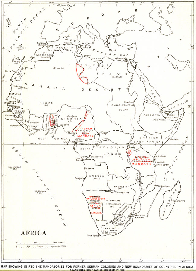
Description: A map from 1921 of Africa showing the territorial changes made after World War I. "Map showing in red the mandatories for former German colonies and new boundaries of countries in Africa. Abandoned Boundaries crossed in red." — Department of the Interior, 1921
Place Names: A Complete Map of Africa, Algeria, �Congo, �Egypt, �Madagascar, �Nigeria, �South Africa, �Sudan, �Abyssinia, �Rhodesia, �Tunis, �Eritrea, �Tripoli,
ISO Topic Categories: boundaries
Keywords: Africa, physical, �political, physical features,
geological, country borders, boundaries, Unknown, 1921
Source: Department of the Interior , World Atlas of Commercial Geology (Washington, DC: Department of the Interior , 1921) 8
Map Credit: Courtesy the private collection of Roy Winkelman |
|