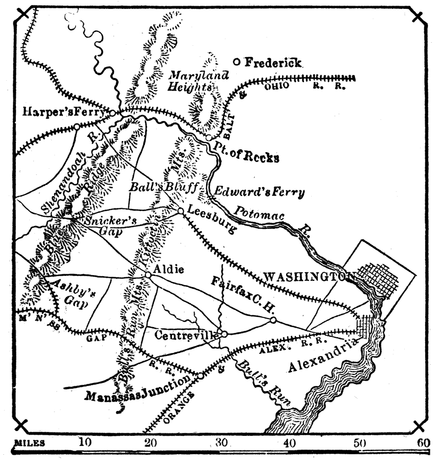
Description: "Manassas Junction. Important actions were fought here during the civil war, namely, the first and second battle of Bull Run, July 21, 1861, and Aug. 30, 1862, respectively. In both actions the confederate troops gained decisive victories." — W. H. DePuy, 1881
Place Names: Civil War, Washington D.C., �Maryland Heights, �Harper's Ferry, �Potomac River, �Alexandria, �Bull's Run Mountains, �Manassas Junction, �Fairfax Court Hous
ISO Topic Categories: inlandWaters,
society,
transportation
Keywords: Vicinity of Manassas Junction, physical, �transportation, �historical, physical features,
topographical, roads,
railroads,
water routes, Civil War, inlandWaters,
society,
transportation, Unknown, 1861
Source: W. H. DePuy, People's Cyclopedia of Universal Knowledge: V.2 (New York, NY: Phillips & Hunt, 1881) 1106
Map Credit: Courtesy the private collection of Roy Winkelman |
|