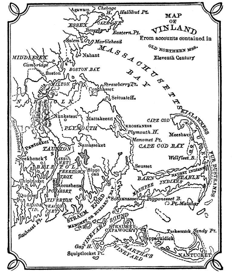
Description: A map of Massachusetts Bay and Cape Cod showing the area of early Norse exploration in America. "In 986 A.D. a Norseman named Herjulfson, who was voyaging from Iceland to Greenland, was driven by a gale far out of his reckoning to the W. A bold, rugged, coast-line was seen several times, probably that of Newfoundland or Labrador, but no landing was effected. That he account of this adventure was related with sundry embellishments on their return to Iceland we may well believe. In the y. 1000, Lief Ericsson, bearing in mind the tale told by his predecessor, set out with the avowed object of testing the truth of this report. He also, in the spring of the y. 1001, reached Labrador, landed and found the country far superior to his own rugged Iceland. ‘Southward he went,’ says Mr. Ridpath, ‘as far as Mass., where the daring company of Norsemen remained for more than a y. R.I. was also visited; and it is alleged that the hardy adventurers found their way into New York harbor.’ ... But their curiosity was soon appeased; one by one the colonies dissolved; there was no glory in fighting a few naked savages; and Vinland, as the new discovery had been called, was once more left untrodden by the white man." — W. H. DePuy, 1881.
Place Names: Massachusetts, Boston, �Nantucket, �Cape Cod, �Cambridge, �Salem, �Chappaquidick, �Martha's Vineyard, �Straum Fjord, �Kjalarness Furdustrand
ISO Topic Categories: boundaries,
inlandWaters,
oceans,
society
Keywords: Vinland, from Accounts Contained in Old Northern Maps, physical, �political, �statistical, �historical, physical features, county borders, ethnological, boundaries,
inlandWaters,
oceans,
society, Unknown, Eleventh Century
Source: W. H. DePuy, People's Cyclopedia of Universal Knowledge: V.2 (New York, NY: Phillips & Hunt, 1881) 1251
Map Credit: Courtesy the private collection of Roy Winkelman |
|