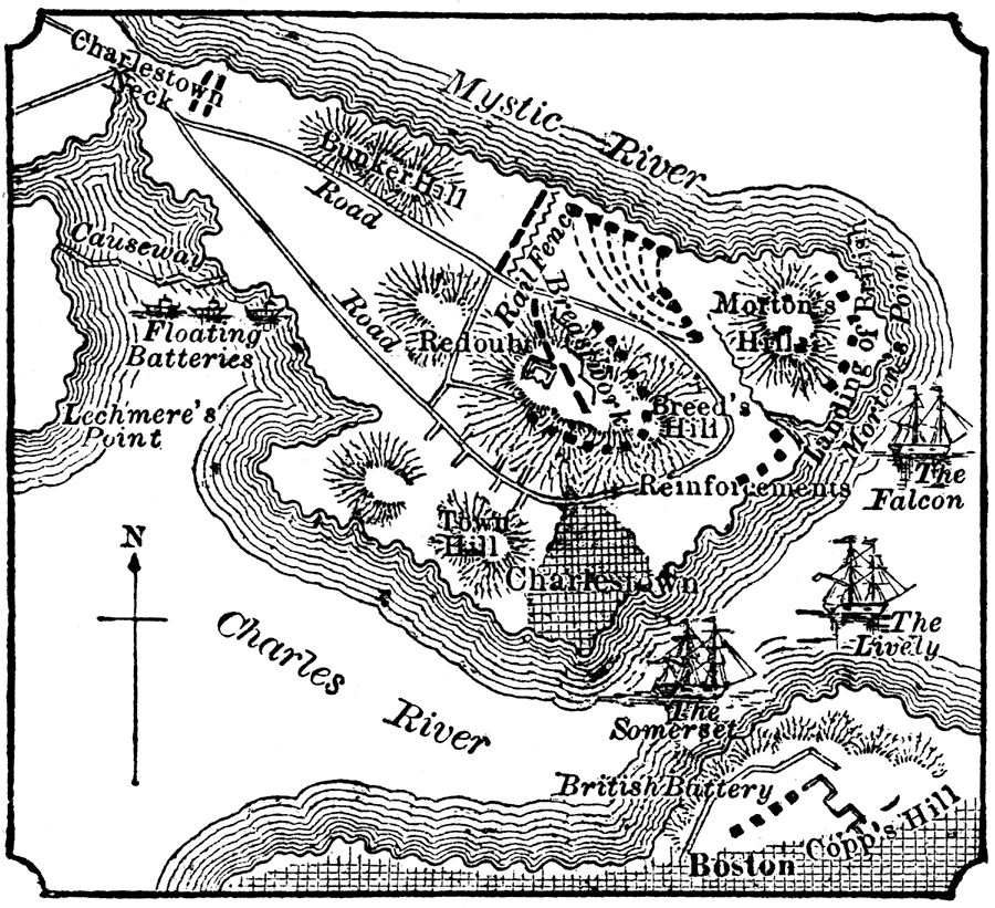
Description: A plan of the Battle of Bunker Hill (June 17, 1775) showing the Charles and Mystic rivers, the city of Charlestown, Breed's Hill, Bunker Hill, Morton's Hill, Charlestown Neck, the landing point of the British, the rail fence, and the positions of the ships Falcon, Lively, and Somerset.
Place Names: Massachusetts, Boston, �Bunker Hill, �Mystic River, �Charles River, �Copp's Hill, �Charlestown,
ISO Topic Categories: society
Keywords: Scene of the Battle of Bunker Hill, physical, �transportation, �historical, kAmericanRevolution, physical features,
topographical, water routes,
roads, American Revolution, society, Unknown, June 17, 1775
Source: W. H. DePuy, People's Cyclopedia of Universal Knowledge: V.2 (New York, NY: Phillips & Hunt, 1881) 1488
Map Credit: Courtesy the private collection of Roy Winkelman |
|