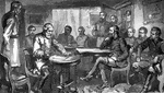
Terms of Surrender
"General Lee singing the Terms of Surrender at Appomattox court-house."—E. Benjamin Andrews 1895
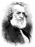
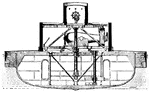
John Ericsson
"John Ericsson invented the screw propeller and designed the USS Monitor."—E. Benjamin…
Salmon Portland Chase
"Salmon Portland Chase, Secretary of the Treasury during the Civil War."—E. Benjamin Andrews 1895
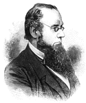
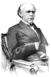
Edwin M. Stanton
"Edwin M. Stanton was Attorney General and Secretary of War during the Civil War."—E. Benjamin…
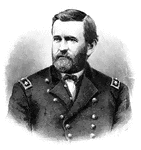
Ulysses S. Grant
"Ulysses S. Grant, president of the United States after the Civil War."—E. Benjamin Andrews 1895
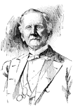
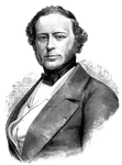
Samuel J. Tilden
"Samuel J. Tilden helped to reform the Democratic Party after the Civil War and ran for president."—E.…
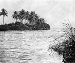
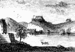
Miami River
"The mouth of th Miami River, Florida, whenever Florida started to be devloped in the 1890's."—E.…
first interview
Site of the first interview between Gates and Burgoyne. This view is taken from the turnpike, looking…
Long Point
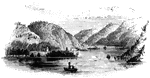
Long Point and vicinity. This little sketch was taken from the steam-boat , near the south end of Long…
Roger's Rock
Roger's Rock. This sketch is from the lake, a little south of Cook's Point, seen just over the boat…
Fort Anne
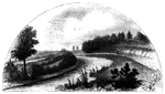
Site of Fort Anne. This view is from the bridge which crosses Wood Creek, looking south. The distant…
Fort at Chambly
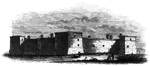
Fort at Chambly, this is a view of the south and west sides of the fort, looking toward the river. It…
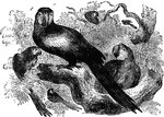
Parakeet Macaw
Native to South America, the parakeet macaw is renowned for its powers to imitate human speech.
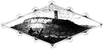
Cape Diamond
Cape Diamond, this is a view of the spot where Montgomery was killed. The cliff is Cape Diamond, crowned…
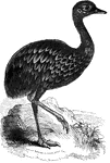
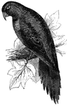
Pantagonian Rhea
Found in Southern Pantagonia, the Pantagonian rhea's plumage is of a dark, mottled color.
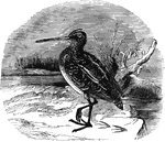
European Snipe
Ranging as far north as Scandanavia, Iceland, and Greenland in the summer, the European snipe migrates…
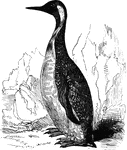
King Penguin
Also known as the pantagonian penguin, the king penguin is found in the far southern latitudes of South…
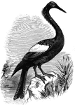
Anhinga
Also known as the snake-bird, the anhinga inhabits the freshwater areas of the South Atlantic States;…
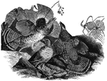
Matamata tortoise
Primarily nocturnal, the matamata tortoise of South America feeds on small reptiles and fish.
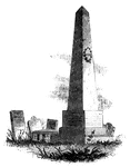
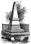
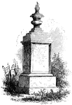
Caldwell's Monument
Caldwell's monument. The following are the inscriptions upon the Caldwell monument: East Side: "This…
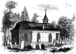
Liberty Hall
Liberty Hall. Some time after the death of Governor Livingston this property was purchased by Lord Blingbroke,…
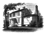
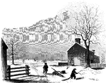
Agnew and Erskine
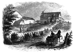
Head-quarters of Agnew and Erskine. This house is on the south bank of Still River, at the north end…
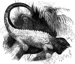
Common iguana
A large lizard, the common iguana is common to the tropical regions of the Americas. It spends much…
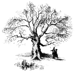
Charter Oak
The Charter Oak. This venerable relic is still virgorous, and is a "gnarled oak" indeed. It stands upon…
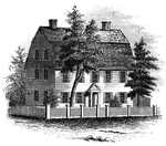
Webb House
The Webb House. This house is still standing (1848), in the central part of Wethersfield, a few rods…
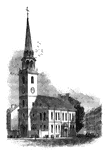
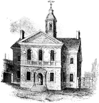
Old South
"The Old South. This venerable and venerated edifice, that stood through all the storms of the Revolution,…
Williams landing-place
"Landing-place of Roger Williams. This view is on the left bank of the Seekonk, looking south. The point…
Tonomy Hill
"Top of Tonomy Hill. This view is from the northside of the hill, looking south. The wall appearance…
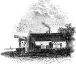
Hubbard's House and Mill
"Hubbard's House and Mill. The inscriptions upon the monument are as follows: East Side: "Oliver Hazard…
West Point
"West Point in 1780. This view is from a print published in the New York Magazine for 1790.…
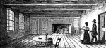
Breakfast Room
"The Breakfast Room. This is a view of the room in the Robinson House in which Arnold was at breakfast…
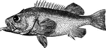
Bergylt
"Is twelve to twenty-four inches long; found in the northern seas, south to the coast of Massachusetts;…
Sleepy Hollow Church
"Ancient Dutch Church in Sleepy Hollow. This view is from the church-yard, looking southwest. The porch…
Van Wart's Monument
"Van Wart's monument. The following are the inscriptions upon this monument: North Side: 'Here repose…
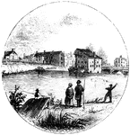
Trenton
"Trenton Bridge and vicinity. This view is from the north side of the Assanpink, a few rods above the…
Princeton battle-ground
"View of the battle-ground near Princeton. This view, looking north, is from the carriage gate of Mr.…
Treaty Monument
"Treaty Monument. This monument stands near the intersection of Hanover and Beach Streets, Kensington,…
Carpenters' Hall
"Carpenters' Hall. This building is constructed of small imported bricks, each alternate one glazed,…
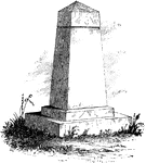
Woodhull's Monument
"Woodhull's Monument. This monument stands on the south side of the church. It is of white marble, about…
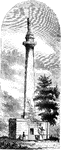
Washington Monument
"Washington Monument. The following are the inscriptions on the monument: East front: 'To George Washington,…
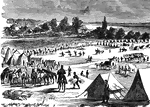
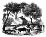
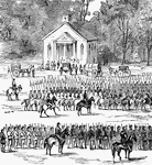
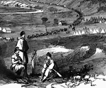
Camp Zagonyi
"Camp Zagonyi, encampment of Fremont's army on the prairie, near Wheatland, Mo., October 14th, 1861.…
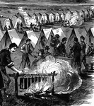
Camp Zagonyi
"Camp Zagonyi, encampment of Fremont's army on the prairie, near Wheatland, Mo., October 14th, 1861.…
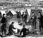
Camp Zagonyi
"Camp Zagonyi, encampment of Fremont's army on the prairie, near Wheatland, Mo., October 14th, 1861.…
Battle at Willis Church
"Battle at Willis Church, Monday, June 30th, 1862- the Federal forces, under General Heintzelman, engaged…
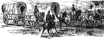
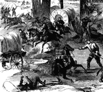
Burning of the White House
"Burning of the White House- the Federal troops, by command of General McClellan, abandoning their position…
Strasburg Lookout
"View of the town of Strasburg, valley of the Shenandoah, occupied by the Federal forces under General…
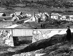
Bridge at Strasburg
"View of the town of Strasburg, valley of the Shenandoah, occupied by the Federal forces under General…
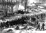
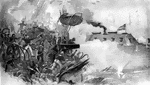
Battle of Stone River
"Battle of Stone River, Tenn. The decisive charge of General Negley's division across the river- the…
Battle of Stone River
"Battle of Stone River, Tenn. The decisive charge of General Negley's division across the river- the…