Clipart tagged: ‘cartography’
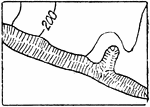
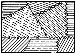
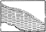
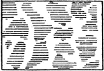
Bluffs, Other than Rocky
The typical representation of bluffs (other than rocky) on a topographical map.
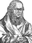
Sebastian Cabot
Italian navigator and cartographer. Sebastian Cabot (c. 1474 – c. December 1557) was an Italian explorer,…
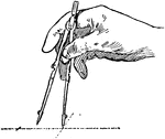
Adjusting the Compass
In changing the compass from a small to large radius, hold the legs together with one hand and spin…
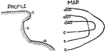
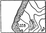
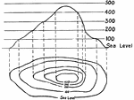
Contour Lines
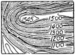
Contour lines never cross on the ground but in rare cases as an overhanging cliff they may cross on…
Contour Lines
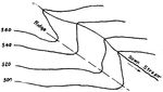
A contour about to cross a stream runs up one side and down the other, making a V where it crosses,…
Contour System
In cartography, a contour line (often just called a "contour") joins points of equal elevation (height)…
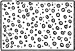
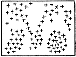
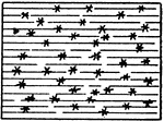
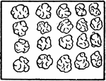
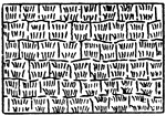
Cultivated Fields in General
The typical representation of cultivated fields in general on a topographical map.
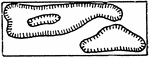
Depression Contours
The typical representation of depression contours, if otherwise ambiguous, on a topographical map.
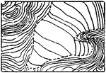
Glacier Contours
In cartography, a contour line (often just called a "contour") joins points of equal elevation (height)…
Glacier Form Lines
In cartography, a contour line (often just called a "contour") joins points of equal elevation (height)…
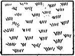
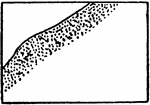
Gravel and Rocks
The typical representation of shores and low-water lines with gravel and rocks on a topographical map.
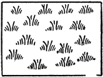
Fresh Marsh
The typical representation of a marsh in general (or fresh marsh) on a topographical map.
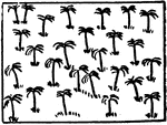
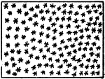
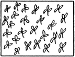
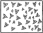
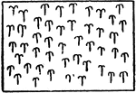
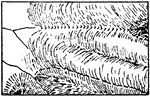
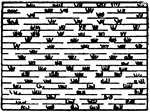
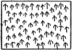
Pine (or Narrow Leaved Trees)
The typical representation of pine trees or any other narrow leaved trees on a topographical map.
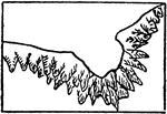
Rocky Ledges
The typical representation of shores and low-water lines with rocky ledges on a topographical map.
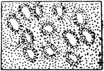
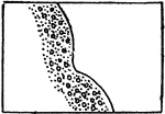
Tidal Flats of any Kind
The typical representation of shore lines and low-water lines with tidal flats of any kind on a topographical…
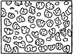
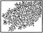
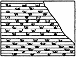
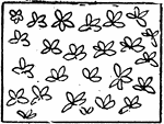
Woods of any Kind (or Broad Leaved Trees)
The typical representation of any kind of woods or broad leaved trees on a topographical map.