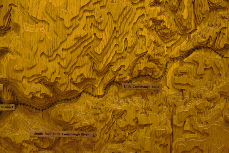
A Section of a Model Showing the Topography along the Little Conemaugh River
This topographic model shows the shape of the terrain along this section of the Allegheny Portage Railroad. This section shows the topography along the Little Conemaugh River. This visitor center is listed on the National Register of Historic Places, as part of the Allegheny Portage Railroad National Historic Site.Galleries:Allegheny Portage Railroad, Other ModelsKeywords:allegheny portage railroad, gallitzin, little conemaugh river, model, pennsylvania, physiography, topographical models, topography, wooden modelsPhoto Location: Allegheny Portage Railroad National Historic Site, PennsylvaniaPhotographer: Dr. Roy WinkelmanDate of Photo: 11/25/2011Device Make: CanonDevice Model: Canon EOS 5D Mark IIOriginal Dimensions: 5616×3744Picture Orientation: LandscapeGPS Coordinates: 40°27'26.33"N 78°32'57.61"WPicture Number: 15753
WARNING: You are about to download a 45.3 MB TIFF!
Normally such a large file is only needed for high quality printing purposes. If you are certain that you need such a large file, click the DOWNLOAD button to begin.
If you do not wish to download the large TIFF, just click the × in the top right-hand corner to close this alert.