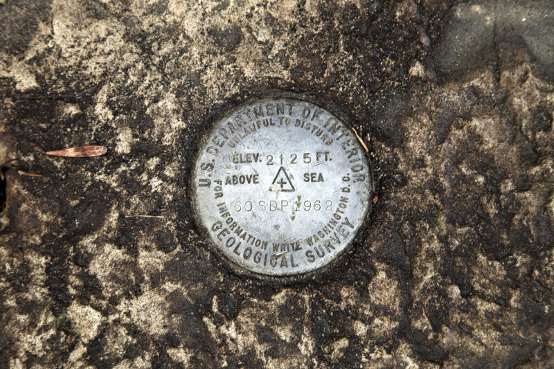
This is United States Geological Survey (USGS) benchmark. This particular benchmark was placed at an elevation of 2125 feet above sea level, in 1962. These benchmarks provide a known elevation, which can be a useful reference for local surveying tasks.Galleries:Allegheny Portage Railroad, SurveyingKeywords:allegheny portage railroad, benchmark, elevation marker, gallitzin, pennsylvania, skew arch bridge, surveying, united states geological survey benchmarkPhoto Location: Skew Arch Bridge, Allegheny Portage Railroad National Historic Site, PennsylvaniaPhotographer: Dr. Roy WinkelmanDate of Photo: 11/25/2011Device Make: CanonDevice Model: Canon EOS 5D Mark IIOriginal Dimensions: 5616×3744Picture Orientation: LandscapeGPS Coordinates: 40°27'11.00"N 78°32'34.23"WPicture Number: 15905
WARNING: You are about to download a 45.0 MB TIFF!
Normally such a large file is only needed for high quality printing purposes. If you are certain that you need such a large file, click the DOWNLOAD button to begin.
If you do not wish to download the large TIFF, just click the × in the top right-hand corner to close this alert.