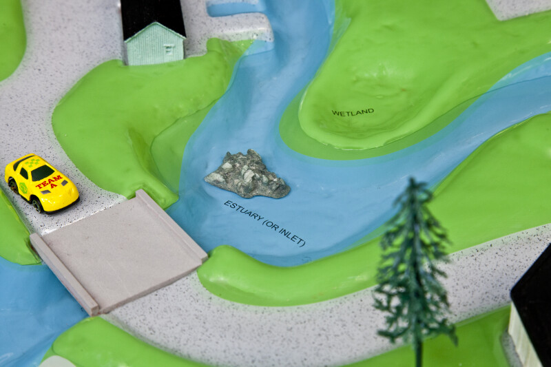
Detail of the estuary (or inlet) of the plastic watershed model used by the Southwest Florida Water Management District to demonstrate the flow of water in coastal regions. Various activities demonstrate how pollutants can be carried into the estuary and how the wetlands can capture those pollutants before contaminating the estuary.Galleries:Estuaries, Shorelines, Watershed ModelKeywords:coast, estuary, inlet, model, water pollution, watershed, wetlandsPhoto Location: FCIT Photo Studio, Tampa, FLPhotographer: Dr. Roy WinkelmanDate of Photo: 08/04/2013Device Make: CanonDevice Model: Canon EOS 5D Mark IIExposure Time: 0.04F Number: 14Original Dimensions: 5616×3744Picture Orientation: LandscapeGPS Coordinates: 28°3'40.85"N 82°24'36.26"WPicture Number: 23082
WARNING: You are about to download a 36.7 MB TIFF!
Normally such a large file is only needed for high quality printing purposes. If you are certain that you need such a large file, click the DOWNLOAD button to begin.
If you do not wish to download the large TIFF, just click the × in the top right-hand corner to close this alert.