Maps Site map
  Maps > Africa > Egypt
Site Map  

  Record   11   to   20  of   26

A collection of historic and contemporary maps of Egypt, including ancient empires and significant Egyptian sites.

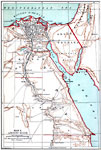
Colonial Egypt, 1912
Map of Egypt from the Nile Delta to Victoria Nyanza (Lake Victoria) in 1912, subtitled "Egypt Under British Protection and the Anglo–Egyptian Sudan." This map is color–coded to show Egypt proper in light pink and the Anglo Egypt...

Suez Canal, 1912
This map illustrates the route of the Suez Canal through Egypt and the Sinai Peninsula. The manmade canal opened in 1869 and is composed of two parts, separated by the Great Bitter Lake. This map shows the canal route from Port Said on the Tanitic Mo...

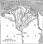
Delta of the Nile, 1916
A map from 1916 of the Nile Delta, showing the water courses of the delta, the Pyramids, Cairo, Alexandria, Rosetta, Damietta, and Port Said and Suez at the openings of the Suez Canal....

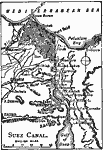
Suez Canal, 1919
A map of the Suez Canal in 1919 from Port Said on the Mediterranean in the north to Port Ibrahim on the Gulf of Suez in the south. The map shows the railroad connecting the city of Suez to Cairo and the rest of the Nile Delta, freshwater canals, mars...

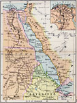
Egypt and the Nile Valley, 1920
A map of Egypt and the Nile Valley from the delta south to the confluence of the Sobat River and the Upper Nile. This map shows Egypt Proper, Nubia, Kordofan, Sudan, Eritrea, and portions of Abyssinia and British Somalia. The map also shows the Red S...

Plan of the Temple of Chons, 2134–1999 BC
This is a plan of the Temple of Chons (Khonsu) in Luxor, Egypt. Egyptian–style architecture. Scale in feet....

Plan of Karnak, 2134–1999 BC
This is a map of the Plan of Karnak, near Luxor, Egypt. Egyptian–style architecture. "The great temple of Karnak...was the work of many successive monarchs" — Enctclopædia Britannica, 1910. The temple is built of granite....

Plan of the Temple of Edfu, 2134–1999 BC
This is a plan of the Temple of Edfu in Egypt. This is an example of Egyptian–style architecture. The key shows the architectural features of the Pylon (A), entrance door (B), Great Court (C), Hall of Columns (D), Second Hall (E), Hall of the A...

Ancient Egypt, 3150 to 31 BCE
A map of ancient Egypt showing the pyramids of Gizeh, the Tombs of Beni Hassan, and various ancient cities. The area known as Upper Egypt is the main focus of the map. Upper Egypt is the area from the First Cataract north to the delta. The First Cata...

Ancient Egypt, 3150 to 31 BCE
A map from 1885 of Egypt showing contemporary and ancient cities of the region, including the borders along the Nile River between the Upper, Middle, and Lower kingdoms from 3150 to 31 BC. The ancient names of cities are given in capital letters. The...

First Previous Next Last


  Maps > Africa > Egypt
Site Map  

Maps ETC is a part of the Educational Technology Clearinghouse
Produced by the Florida Center for Instructional Technology © 2009
College of Education, University of South Florida