|
|
|
| Maps > Africa > Egypt |
A collection of historic and contemporary maps of Egypt, including ancient empires and significant Egyptian sites.
|
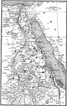
Ancient Egypt,
3150 to 31 BCE |
|
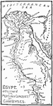
Ancient Egypt,
525 BC |
|
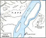
Ruins of Thebes,
about 1250 BCE |
|
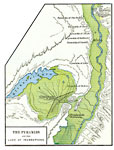
The Pyramids and the Lake of Inundations,
about 2100 BC |
|
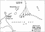
Battle of The Nile,
August 1, 1798 |

|
The Seven Mouths of the Nile,
circa 1250 BC |
| First | Previous |
| Maps > Africa > Egypt |
Maps ETC is a part of the Educational Technology Clearinghouse
Produced by the Florida Center for Instructional Technology © 2009
College of Education, University of South Florida