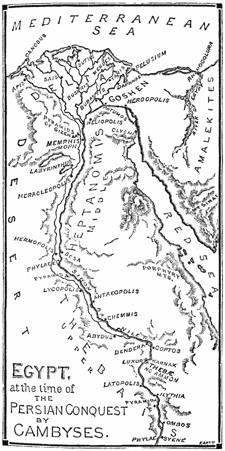
Description: A map of Egypt at the time of the Persian conquest by Cambyses (525 BC) at the end of the Twenty–Sixth Dynasty under Psamtik III. The map shows the delta city of Pelusium and the lower capital of Moph (Memphis) conquered by Cambyses. At this time Egypt was comprised of three divisions, Lower Egypt or the Delta, Middle Egypt or Heptanomis, and Upper Egypt or Thebias. The map shows the Land of Goshen, the Pyramids of Gizeh (Giza) and other pyramid sites, the course of the River Sihon or Nile, and important cities of region, including Canobus, Sais, Heroopolis (Heropolis), Heliopolis, Labyrinthus, Heracleopolis, Hermopolis, Lycopolis, Chemmis, Luxor, Thebæ, Latopolis, Ilythia, Ombos, Phylæ, and Syene.
Place Names: Egypt, Egyp
ISO Topic Categories: oceans,
location,
inlandWaters
Keywords: Ancient Egypt, physical, kAncientEgypt, physical features, oceans,
location,
inlandWaters, 525 BC
Source: William Swinton, Outlines of the World's History (New York, NY: Ivison, Blakeman, and Company, 1874) 13
Map Credit: Courtesy the private collection of Roy Winkelman |
|
