Maps Site map
  Maps > Asia > Burma (Myanmar)
Site Map  

  Record   1   to   2  of   2

A collection of historic and contemporary maps of Burma (Myanmar) for use in the K-12 classroom.

Burma, 1912
A map from 1912 of Burma (Myanmar), showing the political boundaries of the time, including the frontiers with Siam (Thailand), China, and the British Indian province of Assam. The map shows major cities, railroads, terrain, rivers, the mouths and de...

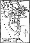
Moulmein, 1919
A map from 1919 of the area around Moulmein (Mawlamyine), Burma (Myanmar), at the time. Moulmein is the third largest city of the country and major trade center and sea port, and this map shows the Salween (Thanlwin) River, Pelew Gewen Island, Mopoon...


  Maps > Asia > Burma (Myanmar)
Site Map  

Maps ETC is a part of the Educational Technology Clearinghouse
Produced by the Florida Center for Instructional Technology © 2009
College of Education, University of South Florida