Maps Site map
  Maps > Asia > Regional Maps >Southeast Asia
Site Map  

  Record   11   to   14  of   14

Regional Asian maps of the Southeast Asia region from the Maps ETC collection. This includes physical and political maps, early history and empires, climate maps, relief maps, population density and distribution maps, cultural maps, and economic/resource maps.
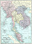
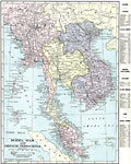
Burma, Siam, and French Indo-China, 1920
A map from 1920 of Burma, Siam, and French Indo-China at the time. The map shows the British possessions of British India (extending to Assam and Burma, or Myanmar) and the Federated Malay States (under protectorate of Britain) in pink, Siam or Thail...

Burma, Siam, and French Indo-China, 1920
A map from 1920 of Burma, Siam, and French Indo-China at the time. The map shows the British possessions of British India (extending to Assam and Burma, or Myanmar) and the Federated Malay States (under protectorate of Britain) in pink, Siam or Thail...

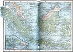
East India Islands, 1922
Islands east of India....

Siam prior to the Franco–Siamese War, Before 1893
A map of Siam (Thailand) prior to the Franco–Siamese War of 1893. This map shows that the Siamese territories at the time included Laos, Cambodia, and the central portion of the Malay Peninsula. "On the eastern peninsula of southern Asia, ...

First Previous


  Maps > Asia > Regional Maps >Southeast Asia
Site Map  

Maps is a part of the Educational Technology Clearinghouse
Produced by the Florida Center for Instructional Technology © 2009
College of Education , University of South Florida