Maps Site map
  Maps > Asia > Regional Maps >Southwest Asia
Site Map  

  Record   1   to   10  of   39

Regional Asian maps of the Southwest Asia region from the Maps ETC collection. This includes physical and political maps, early history and empires, climate maps, relief maps, population density and distribution maps, cultural maps, and economic/resource maps.
Syria Before the Conquests of Saladin, 1098–1187
A map of the Syrian region prior to the retaking of Jerusalem by Saladin, Sultan of Egypt in 1187. The map shows the Seljuk territories and the Crusader States established during the first and second crusades, with their dates of conquest. This map s...

Christian Kingdoms in Syria and Palestine, 1142
A map of Palestine and the Mediterranean region of Syria at the end of the first Crusade, showing the Christian kingdoms or Crusader states established at the time. The map shows the boundaries of Cilicia and Edessa on the frontier with Iconium, and ...

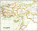
Asia Minor, 1150–550 BC
A map of Asia Minor showing the kingdoms and provinces that existed from about 1150 BC to 550 BC, before being conquered by the Persian Empire. The map shows the territories of Mysia, Lydia, Caria and the islands along the &Aelig;gean, Bithynia, Paph...

Ottoman Empire in Asia, 1800s
A map from 1912 showing the Ottoman Empire in Asia since 1792. This map is color-coded to show the Ottoman territory in Asia Minor from the Black Sea through Mesopotamia to the Persian Gulf and along the Mediterranean to Egypt, the territories around...

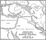
Bagdad Railroad, 1888–1914
A map of the Anatolian Railway and Bagdad Railway, between 1888 and 1914. During this period, Germany was developing her colonies in East Africa and Kiauchau (Jiaozhou, China), and an overland route bypassing the British controlled Suez Canal to the ...

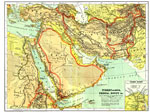
Turkey in Asia, Persia, Egypt , 1904
The Middle East, including Egypt, Turkey, Syria, the Arabian Peninsula, Persia, and Afghanistan showing country borders current to 1904, capitals and major cities, railroad lines, canals and navigable rivers. Physical features include mountain ranges...

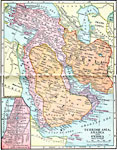
Turkish Asia, Arabia and Persia, 1906
A map from 1906 of Asia Minor and the Arabian Peninsula, showing the extent of the Turkish Ottoman Empire and Persia at the time. The map shows Oman and the British possession of Aden on the Arabian Peninsula, and the frontiers of the Russian Empire,...

The Levant, 1914–1919
A map from 1919 of the Levant region (Asia Minor, Syria, and Palestine) showing borders and territories after World War I. The map shows principal cities and ports, railroads, mountain systems, rivers, islands, and coastal features, including Smyrna ...

Palestine and Mesopotamia Fronts, 1914–1919
A map from 1919 of the battle front between Turkey and Palestine–Mesopotamia on November 11, 1918. The map shows countries and capitals, possessions, principal cities and ports, railroads, rivers, and coastal features....

Turkish Armenia, 1915
The portions of Turkey that make up the nation of Armenia. Six Turkish vilayets in the northeastern part of Asia Minor constitute Armenia. The Armenian nation is one of the oldest in the world; the Armenian church is the oldest state Christian churc...

Next Last


  Maps > Asia > Regional Maps >Southwest Asia
Site Map  

Maps is a part of the Educational Technology Clearinghouse
Produced by the Florida Center for Instructional Technology © 2009
College of Education , University of South Florida