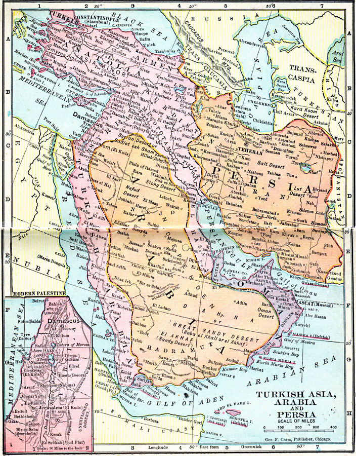
Description: A map from 1906 of Asia Minor and the Arabian Peninsula, showing the extent of the Turkish Ottoman Empire and Persia at the time. The map shows Oman and the British possession of Aden on the Arabian Peninsula, and the frontiers of the Russian Empire, Afghanistan, Egypt, Nubia, and the Somali coast. The map shows capitals and major cities, railways, the Suez Canal, rivers, and coastal features. An inset map details the Palestine region under Ottoman control.
Place Names: Southwest Asia, Anatolia, �Arabia, �Persia, �Syria, �Teheran, �Turkey,
ISO Topic Categories: boundaries,
inlandWaters,
location,
oceans
Keywords: Turkish Asia, Arabia and Persia, physical, �political, �borders, �boundaries, �physical features, country borders, boundaries,
inlandWaters,
location,
oceans, Unknown, 1906
Source: George F. Cram , Cram's Quick Reference Atlas and Gazetteer of the World (Chicago , IL: George F. Cram Series of Atlases, 1906) 93
Map Credit: Courtesy the private collection of Roy Winkelman |
|