|
|
|
| Maps > Astronomical > Solar System |
A collection of maps of the Solar System and Planetary Earth maps.
|
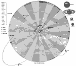
The Solar System,
1873 |
|
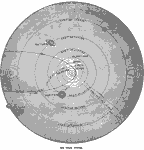
Solar System,
1885 |
|
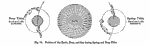
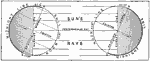
Position of the Earth, Moon, and Sun during Spring and Neap Tide,
1891 |
|
Effect of Rotation,
1899 |
|
Effect of Rotation,
1899 |
|
Effect of Rotation,
1899 |

|
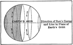
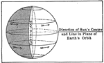
Earth's Inclination of Axis,
1901 |
|
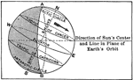
Effects of Earth's Inclination,
1901 |
|
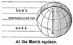
March Equinox,
1901 |
|
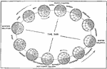
Inclination of Earth on Solstices,
1901 |
| Next | Last |
| Maps > Astronomical > Solar System |
Maps ETC is a part of the Educational Technology Clearinghouse
Produced by the Florida Center for Instructional Technology © 2009
College of Education, University of South Florida