|
|
|
| Maps > Australia > New South Wales |
Historic and contemporary maps of New South Wales, Australia, for use in the K-12 classroom.
|
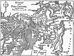
Sydney and Port Jackson,
1909 |
|
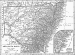
New South Wales,
1911 |
|
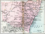
New South Wales,
1920 |
| Maps > Australia > New South Wales |
Maps ETC is a part of the Educational Technology Clearinghouse
Produced by the Florida Center for Instructional Technology © 2009
College of Education, University of South Florida