Maps Site map
  Maps > Europe > Ireland
Site Map  

  Record   41   to   50  of   51

A collection of historic and contemporary maps of Ireland, including detailed travel maps.
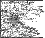
Dublin, Ireland, 1914
A map of Dublin, Ireland, in 1914, showing major streets and roads, canals, railways, and neighboring towns. The map shows historical landmarks, Dublin Bay from Howth in the north to Dalkey in the south, the harbor walls (jetties), light house, and t...

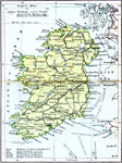
Ireland Communications, 1920
A map of Ireland in 1920 showing primary and secondary railway routes with the line names, transportation canals, and steamship routes with distances between ports shown in nautical miles. The map shows major cities, ports, rivers, and lakes of Irela...

Ireland Climate, 1920
A climate map of Ireland in 1920 showing the average annual rainfall in inches, January and July isotherms in degrees Fahrenheit, and prevailing wind direction....

Ireland Plate I, 1920
A map of the northern section of Ireland in 1920, showing cities, towns, ports, railways, canals, rivers, lakes, and coastal features north of Dublin and Galway. The map is color–coded to clearly show county boundaries....

Dublin, 1920
A map of Dublin, Ireland, in 1920, showing major streets and roads, canals, railways, city boundary, and neighboring towns. The map shows historical landmarks, contour–colored detail of water depth in Dublin Bay, the harbor walls (jetties), lig...

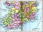
Ireland Plate II, 1920
A map of the southern section of Ireland in 1920, showing cities, towns, ports, railways, canals, rivers, lakes, and coastal features south of Dublin and Galway. The map is color–coded to clearly show county boundaries....

Killarney District, 1920
A map of the Killarney District of Ireland in 1920, showing portions of Kerry and Cork counties between Killarney and Bantry Bay. This map shows cities, towns and ports, railways, roads, rivers, lakes, mountains, and coastal features of the region....

Ireland, 1920
A map of Ireland in 1920 showing major cities, ports, railroads, canals, steamship routes and historic battlefields....

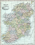
Ireland, 1920
A map of Ireland in 1920 showing major cities, ports, railroads, canals, steamship routes and historic battlefields. This map has a reference key to the Irish counties, cities, and towns....

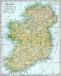
Ireland, 1920
A map showing Ireland as it was in 1920. ...

First Previous Next Last


  Maps > Europe > Ireland
Site Map  

Maps ETC is a part of the Educational Technology Clearinghouse
Produced by the Florida Center for Instructional Technology © 2009
College of Education, University of South Florida