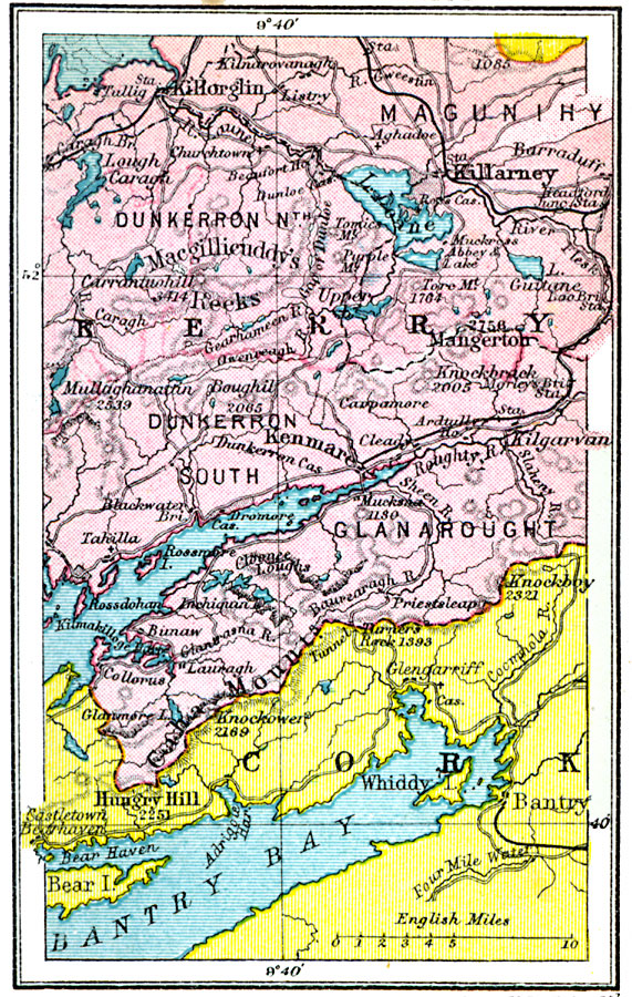
Description: A map of the Killarney District of Ireland in 1920, showing portions of Kerry and Cork counties between Killarney and Bantry Bay. This map shows cities, towns and ports, railways, roads, rivers, lakes, mountains, and coastal features of the region.
Place Names: Ireland, Killorglin, �Killarney, �Mangerton, �Kenmare, �Whiddy, �Bantry, �Macgillicuddy's Reek
ISO Topic Categories: boundaries,
inlandWaters,
location,
oceans
Keywords: Killarney District, physical, �political, physical features, major political subdivisions, boundaries,
inlandWaters,
location,
oceans, Unknown, 1920
Source: , Asprey's Atlas of the World (London, England: Asprey and Co., Ltd., 1920) 43
Map Credit: Courtesy the private collection of Roy Winkelman |
|