Maps Site map
  Maps > South America > Complete Maps
Site Map  

  Record   21   to   30  of   77

Historic and contemporary maps of South America, including physical and political maps, early exploration and colonization period, climate maps, relief maps, population density and distribution maps, vegetation maps, and economic/resource maps.

South America, 1899
A map of South America from 1899 showing the political boundaries of the time. The map shows capitals, major cities, ports, railroads, rivers, and coastal features. The site of the proposed new capital of Brazil (Brasilia) is shown. Longitudes from G...

Physical Map of South America, 1901
A map from 1901 of South America showing the general physical features including mountain systems, prominent peaks and volcanoes, river and lake systems, plateaus, and coastal features. The map is color–coded with the highlands above 2000 feet ...

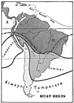
South American Heat Belts, 1901
A map from 1901 of the Heat Belts in South America showing the Heat Equator in July, regions where it is always hot, regions of temperate winters and hot summers, and regions where it is always temperate. "There is comparatively little differenc...

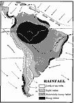
South American Rainfall, 1901
A map from 1901 showing mean annual rainfall in South America. The map shows the equatorial rain belt in July and in January, the direction of prevailing winds and their effect on rainfall patterns. The map shows regions ranging from little or no rai...

South America, 1901
A map of South America from 1901 showing the political boundaries of the time. The map shows capitals, major cities, ports, railroads, rivers, and coastal features. An inset map shows the Isthmus of Panama with the railroad from the Caribbean Sea to ...

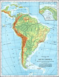
South America (Physical), 1901
A map from 1901 of South America showing the physical features of the region. This map is color–coded to show general elevations from sea level to over 6,500 feet, mountain systems, drainage divides, lakes, rivers, coastal features, and the maj...

South America, 1901
A map from 1901 of South America showing the political boundaries at the time, including Columbia (extending to Costa Rica), Venezuela, Guiana (British, Dutch, and French), Ecuador, Peru, Brazil, Bolivia, Chile, Argentine Republic, and Uruguay. Major...

Physical Map of South America, 1902
A map from 1902 of South America showing the general physical features including mountain systems, prominent peaks and volcanoes, river and lake systems, plateaus, and coastal features. The map is color–coded with the highlands above 2000 feet ...

South America, 1902
A map from 1902 of South America showing the national boundaries at the time. The map shows capitals, major cities, ports, railroads, canals, rivers, and coastal features. Railroads appear as red lines, with important trunk lines shown heavier than o...

South America, 1903
A map from 1903 showing the national boundaries of South America at the time (note the boundaries between Peru and Bolivia, and that Columbia, Ecuador, and Panama are shown as one country). The map shows capitals and major cities, towns, ports, river...

First Previous Next Last


  Maps > South America > Complete Maps
Site Map  

Maps ETC is a part of the Educational Technology Clearinghouse
Produced by the Florida Center for Instructional Technology © 2009
College of Education, University of South Florida