Maps Site map
  Maps > South America > Uruguay
Site Map  

  Record   1   to   2  of   2

Historic and contemporary maps of Uruguay for use in the K-12 classroom.
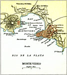
Montevideo Uruguay, 1911
A map from 1911 of the environs of Montevideo, capital of Uruguay, on the mouth of the Rio de La Plata. The map shows the Bay of Montevideo and terrain, including the important hill Monte Video or El Cerro, the docks, best anchorage points, major tho...

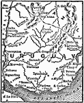
Uruguay, 1916
A map from 1916 of Uruguay showing the political boundaries at the time, the capital city of Montevideo on the Atlantic coast and other major cities, rivers, terrain, and coastal features....


  Maps > South America > Uruguay
Site Map  

Maps ETC is a part of the Educational Technology Clearinghouse
Produced by the Florida Center for Instructional Technology © 2009
College of Education, University of South Florida