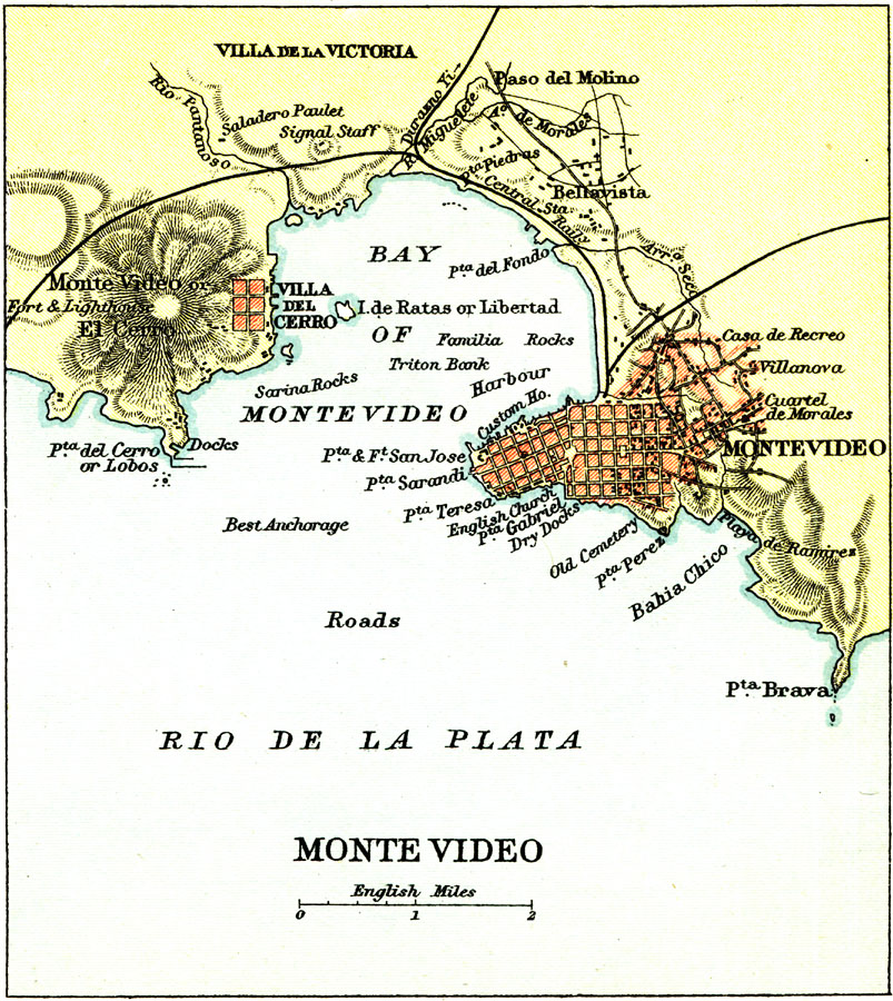
Description: A map from 1911 of the environs of Montevideo, capital of Uruguay, on the mouth of the Rio de La Plata. The map shows the Bay of Montevideo and terrain, including the important hill Monte Video or El Cerro, the docks, best anchorage points, major thoroughfares, railways and stations, hospital, churches, and harbor area along the Rio de La Plata (La Plata River). The barrios and, at that time, neighboring cities of Villa del Cerro, Villa de la Victoria, Paso del Molino, and Bellavista are shown.
Place Names: Uruguay, Uraguay, �Montevideo, �Rio de la Plat
ISO Topic Categories: society
Keywords: Montevideo Uruguay, political, �physical, physical features, society, Unknown, 1911
Source: Ernest Rhys, Ed., A Literary and Historical Atlas of North & South America (New York, NY: E.P. Dutton & CO., 1911) 95
Map Credit: Courtesy the private collection of Roy Winkelman |
|