Maps Site map
  Maps > United States > Maine
Site Map  

  Record   11   to   20  of   40

A collection of historic and contemporary political and physical maps of Maine, including early exploration and settlement maps, and automobile route maps, for use in the K-12 classroom.

Maine, 1891
A map from 1891 of Maine showing the State capital of Augusta, major cities, towns and ports, railroads, lakes, rivers, and coastal features....

Maine, 1906
A map from 1906 of Maine showing the State capital of Augusta, major cities, towns and ports, railroads, lakes, rivers, and coastal features....

Maine, 1909
A map from 1909 of Maine showing the State capital of Augusta, major cities, towns and ports, railroads, mountains, lakes, rivers, and coastal features....

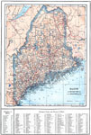
Maine, 1912
A map from 1912 of Maine showing the State capital of Augusta, counties and county seats, major cities, towns and ports, railroads, lakes, rivers, and coastal features. A grid reference in the margins of the map lists counties with populations given ...

Maine, 1914
A map from 1914 of Maine showing the State capital of Augusta, counties and county seats, major cities, towns and ports, railroads, mountains, lakes, rivers, and coastal features. A grid reference at the bottom of the map lists counties, principal ci...

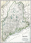
Maine, 1919
A map from 1919 of Maine showing the State capital of Augusta, major cities, towns and ports, railroads, mountains, lakes, rivers, and coastal features....

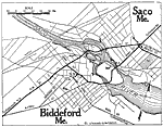
Biddeford, 1919
A road map of Biddeford and Saco, Maine, from the Official Automobile Blue Book (1919), showing the Saco River, major roads, bridges, railroads and stations, parks, and major landmarks....

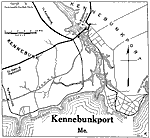
Kennebunkport, 1919
A road map of Kennebunkport, Maine, from the Official Automobile Blue Book (1919), showing the Kennebunk River, Kennebunk Beach, major roads, bridges and drawbridge, railroads and stations, and major landmarks....

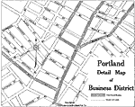
Portland Business District, 1919
A road map of the business district of Portland, Maine, from the Official Automobile Blue Book (1919), showing streets, the suggested Blue Book routes through the area, and the street car lines....

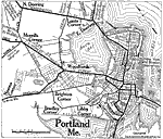
Portland, 1919
A road map of the vicinity of Portland, Maine, from the Official Automobile Blue Book (1919), showing the Fore River, Portland Harbor, major roads, bridges, railroads and stations, parks, cemeteries, and major landmarks....

First Previous Next Last


  Maps > United States > Maine
Site Map  

Maps ETC is a part of the Educational Technology Clearinghouse
Produced by the Florida Center for Instructional Technology © 2009
College of Education, University of South Florida