Maps Site map
  Maps > United States > Massachusetts
Site Map  

  Record   101   to   110  of   113

A collection of historic and contemporary political and physical maps of Massachusetts, including early exploration and settlement maps, Revolutionary War maps, and automobile route maps.

Eastern Massachusetts, 1919
A road map of eastern Massachusetts, Rhode Island, and Connecticut from the Official Automobile Blue Book (1919), showing major roads, cities, and towns in the area....

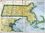
Massachusetts, 1919
A map from 1919 of Massachusetts showing the capital Boston, major cities, towns, and ports, counties and county seats, railroads, mountains, lakes, rivers, and coastal islands and features. An inset map details the vicinity of Boston....

Southern Massachusetts, 1919
A road map of southern Massachusetts in the vicinity of North Grafton and Milford from the Official Automobile Blue Book (1919), showing state and county lines, towns, and roads, and keyed to show the best auto routes, other auto routes, unreported r...

Southern Massachusetts, 1919
A road map of southern Massachusetts in the vicinity of Charlton City and Webster from the Official Automobile Blue Book (1919), showing state and county lines, towns, and roads, and keyed to show the best auto routes, other auto routes, unreported r...

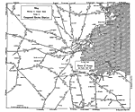
Boston District, 1919
A road map of the district of Boston, Massachusetts, from the Official Automobile Blue Book (1919), showing neighboring cities and major roads in the area. The map is subtitled "Showing in Greater Detail Routes in Congested Boston District."...

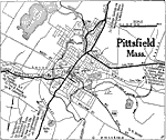
Pittsfield, Massachusetts, 1920
A road map of Pittsfield, Massachusetts, from the Automobile Club of Rochester (1920), showing the major roads, railroads and stations, bridges, parks, cemeteries, and major landmarks....

Massachusetts, 1922
A map from 1922 of Massachusetts showing the capital Boston, major cities, towns, and ports, railroads, mountains, lakes, rivers, islands, and coastal features....

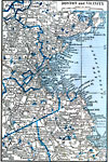
Boston and Vicinity, 1922
A map from 1922 of the vicinity of Boston showing neighboring counties, cities and towns, railroads, lakes, rivers, and coastal features....

Vinland, from Accounts Contained in Old Northern Maps, Eleventh Century
A map of Massachusetts Bay and Cape Cod showing the area of early Norse exploration in America. "In 986 A.D. a Norseman named Herjulfson, who was voyaging from Iceland to Greenland, was driven by a gale far out of his reckoning to the W. A bold,...

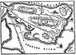
Plan of Bunker Hill, June 17, 1775
A plan of the Battle of Bunker Hill on the Charlestown peninsula of Boston Harbor on June 17, 1775. The map shows the American and British troop positions, the fortification on Breed's Hill, the reinforcement landing of the British, and the artillery...

First Previous Next Last


  Maps > United States > Massachusetts
Site Map  

Maps ETC is a part of the Educational Technology Clearinghouse
Produced by the Florida Center for Instructional Technology © 2009
College of Education, University of South Florida