|
|
|
| Maps > United States > Massachusetts |
A collection of historic and contemporary political and physical maps of Massachusetts, including early exploration and settlement maps, Revolutionary War maps, and automobile route maps.
|
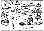
Port St. Louis or Plymouth Bay,
1613 |
|
Plymouth,
1620 |
|
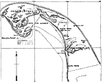
Plymouth Harbor,
1620 |
|
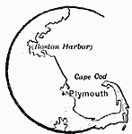
Pilgrim Arrival at Cape Cod Harbor,
1620 |
|
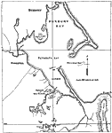
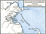
English Settlements around Massachusetts Bay,
1620–1652 |
|
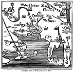
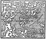
Massachusetts Bay,
1667 |
|
Boston and its Environs,
1775 |
|
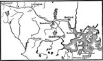
Vicinity of Boston,
1775 |
|
Plan of the Siege of Boston,
1775 |
|
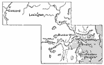
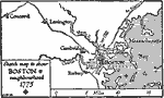
Boston and Neighborhood,
1775 |
| Next | Last |
| Maps > United States > Massachusetts |
Maps ETC is a part of the Educational Technology Clearinghouse
Produced by the Florida Center for Instructional Technology © 2009
College of Education, University of South Florida