|
|
|
| Maps > United States > Meteorology |
A collection of meteorological maps of the United States, including mean annual temperature maps, precipitation records and distribution, and typical storm event patterns.
|
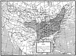
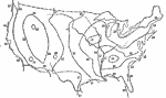
High Pressure Center,
January 16, 1882 |
|
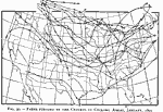
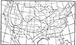
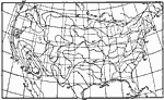
Paths of Cyclonic Areas,
January 1893 |
|
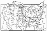
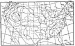
Paths of Anticyclonic Areas,
January 1893 |
|
Average Temperature,
January 1896 |
|
Midwinter Humidity,
January 1896 |
|
Typical Air Pressure and Wind Direction,
January 1896 |
|
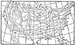
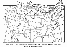
Paths of Cyclonic Areas,
July 1893 |
|
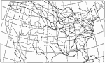
Paths of Anticyclonic Areas,
July 1893 |
|
Hours of Maximum Wind,
July 1896 |
|
Average Temperature,
July 1896 |
| First | Previous | Next | Last |
| Maps > United States > Meteorology |
Maps ETC is a part of the Educational Technology Clearinghouse
Produced by the Florida Center for Instructional Technology © 2009
College of Education, University of South Florida