|
|
|
| Maps > United States > Regional Maps >Midwest States |
|
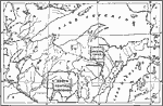
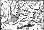
Lake Superior and Michigan,
1911 |
|
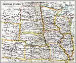
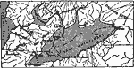
Central States,
1911 |
|
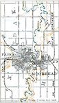
Red River Basin,
1916 |
|
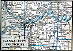
Kansas City and Vicinity,
1922 |
|
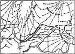
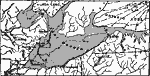
Drainage History of the Southern Great Lake District,
Ice Age |
|
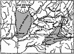
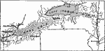
Drainage History of the Southern Great Lake District,
Ice Age |
|
Drainage History of the Southern Great Lake District,
Ice Age |
|
Drainage History of the Southern Great Lake District,
Ice Age |
|
Drainage History of the Southern Great Lake District,
Ice Age |
|
Drainage History of the Southern Great Lake District,
Ice Age |
| First | Previous | Next | Last |
| Maps > United States > Regional Maps >Midwest States |
Maps
is a part of the
Educational Technology Clearinghouse
Produced by the
Florida Center for Instructional Technology
© 2009
College of Education
,
University of South Florida