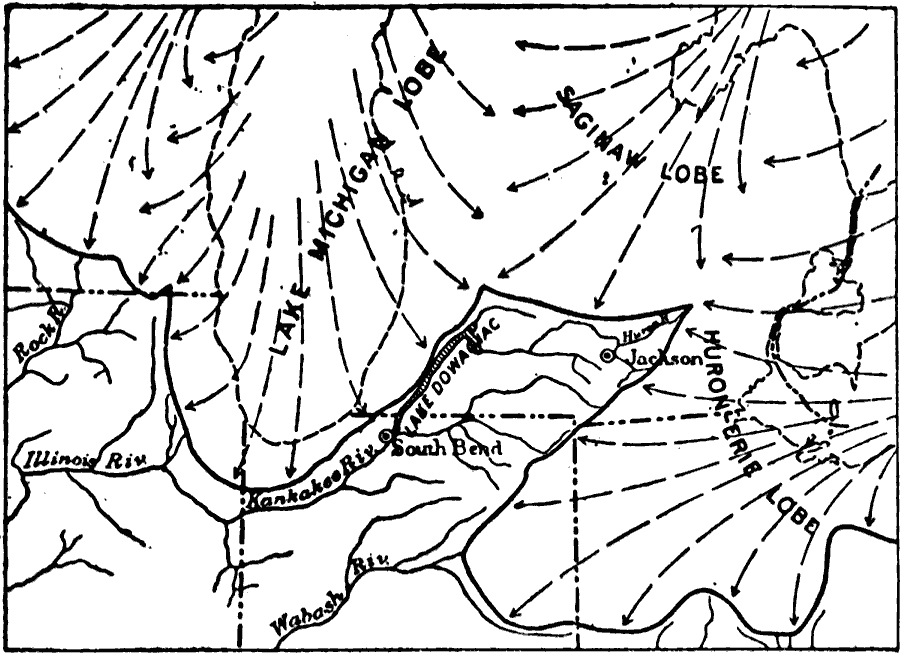
Description: A map from 1911 showing the early drainage history of the southern Great Lake district during the last glacial period, indicating the present lake shorelines (dashed line) and the position of glacial lakes before lakes were formed, including the early Lake Dowagiac. The map shows rivers and the great glacial lobes with direction of flow of the Lake Michigan lobe, Saginaw lobe, and the Huron–Erie lobe.
Place Names: Midwest States,
ISO Topic Categories: boundaries,
geoscientificInformation,
location,
inlandWaters
Keywords: Drainage History of the Southern Great Lake District, physical, kGlacial, physical features, boundaries,
geoscientificInformation,
location,
inlandWaters, Unknown, Ice Age
Source: Isaiah Bowman, Ph. D, Forest Physiography (New York, NY: John Wiley and Sons, 1911) 479
Map Credit: Courtesy the private collection of Roy Winkelman |
|