Maps Site map
 Maps > Africa > A Regional Map of Africa
Site Map 

 Record  11   to   20  of   22

A collection of regional physical and political maps of Africa, including pre-colonial and colonial maps.
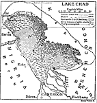
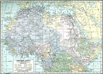
Lake Chad, 1910
This is a map of Lake Chad showing its present coastline (circa 1910) and its coastline previous to 1910. It reveals how Lake Chad is continuously shrinking. "Chad, a lake of northern Central Africa, is situated about 850 ft. above the sea in th...

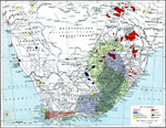
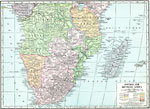
Economic Map of Southern Africa, 1915
A map from 1915 of southern Africa showing main economic products, principal cities, ports, railways, mountains, rivers, and coastal features throughout the region. The map is keyed to show the areas of wine, wool, cattle, and ostrich feather product...

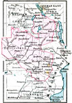
German Territories in Africa, 1915
These three maps show the German Territories in Africa circa 1915. They include Togo, Cameroon, German Southwest Africa (Namibia), and German East Africa (Tanzania). Maps indicate the general relief of each territory, major rivers, and railroad lines...

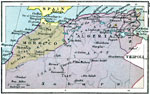
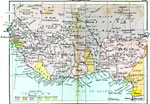
Algeria, Tunis and Morocco, 1920
A map of Morocco, Algeria, and Tunis in 1920 showing major cities, trade centers and railroads in the region. Lakes, rivers, and intermittent rivers are shown, as well as major landforms such as the Atlas and Anti–Atlas Mountains and the Platea...

Colonial West Africa, 1920
Map of Western Africa in 1920 showing the Upper Guinea States of Gambia, Portuguese Guinea, Sierra Leon, Liberia, British Gold Coast, Togo, Dahomey, Northern and Southern Nigeria, Kamerun, and Spanish Guinea. The map also shows the French territories...

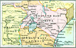
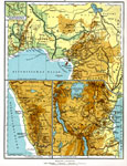
The Lake Victoria Region, 1920
A map of the region around Lake Victoria, or Victoria Nyanza, in 1920, showing the northern portion of German East Africa, the eastern portion of Belgian Congo, and all of British East Africa including the Uganda Protectorate. The map shows neighbori...

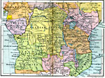
Central Africa, 1920
A map of central Africa in 1920 showing the European colonial claims at the time. The map shows Spanish Guinea, Kamerun, French Congo, Belgian Congo, Uganda Protectorate, British East Africa, German East Africa, Mozambique, Angola, and the northern p...

Rhodesia, 1920
A map of Rhodesia in 1920, including portions of the neighboring territories of the Belgian Congo, German East Africa, Mozambique, and Transvaal. This map shows cities, railways, major rivers and lakes, and includes the names and territories of nativ...

Post WWI Northern Africa, 1920
A political map of the northern part of the African continent after WWI with reference to territories controlled by European countries and showing the former German territories ceded by the Treaty of Versailles to France and Britain. This map include...

Post-WWI Central and Southern Africa, 1920
A map of central and southern Africa in 1920 showing colonial possessions of the British, French, Italian, Portuguese, Spanish, and Belgians, including the former German colonies, lost after WWI, to French and British control per the Treaty of Versai...

First Previous Next Last


 Maps > Africa > A Regional Map of Africa
Site Map 

Maps is a part of the Educational Technology Clearinghouse
Produced by the Florida Center for Instructional Technology © 2007
College of Education, University of South Florida