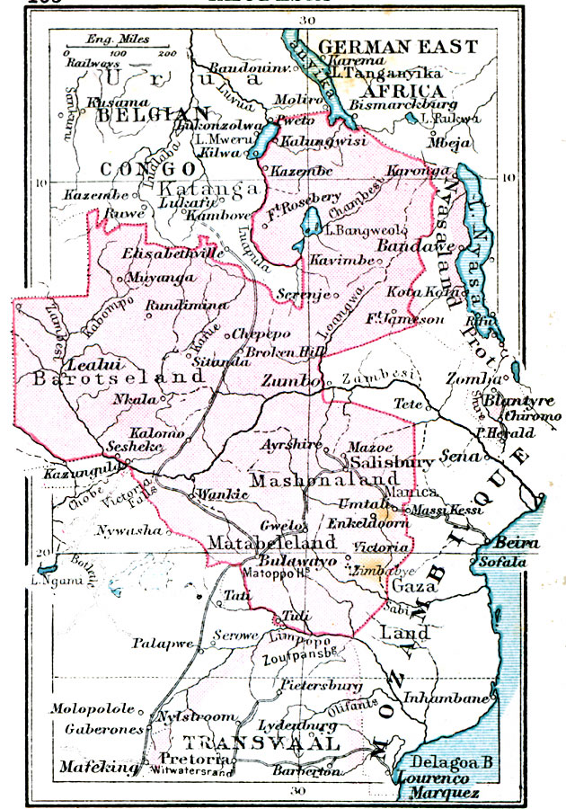
Description: A map of Rhodesia in 1920, including portions of the neighboring territories of the Belgian Congo, German East Africa, Mozambique, and Transvaal. This map shows cities, railways, major rivers and lakes, and includes the names and territories of native groups in the area.
Place Names: A Regional Map of Africa, Lealui, �Zumbo, �Matabeleland, �Mashonaland, �Elisabethville, �Zomba, �Herald, Victoria Falls, Bulawayo, Salisbury
ISO Topic Categories: boundaries,
inlandWaters,
location,
oceans,
transportation
Keywords: Rhodesia, physical, �political, �transportation, physical features, country borders, railroads, boundaries,
inlandWaters,
location,
oceans,
transportation, Unknown, 1920
Source: , Asprey's Atlas of the World (London, England: Asprey and Co., Ltd., 1920) 105
Map Credit: Courtesy the private collection of Roy Winkelman |
|