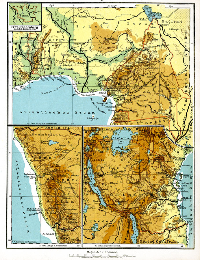
Description: These three maps show the German Territories in Africa circa 1915. They include Togo, Cameroon, German Southwest Africa (Namibia), and German East Africa (Tanzania). Maps indicate the general relief of each territory, major rivers, and railroad lines.
Place Names: A Regional Map of Africa, Congo, �Namibia, �Tanzania, �Togo, �Cameroon, � �Nigeri
ISO Topic Categories: society,
boundaries,
elevation
Keywords: German Territories in Africa, physical, �political, �transportation, physical features, major political subdivisions,
country borders, railroads, society,
boundaries,
elevation, Unknown, 1915
Source: C. Diercke, Lange-Diercke Volksschulatlas (Berlin, : George Westermann, 1915) 16
Map Credit: Courtesy the private collection of Roy Winkelman |
|