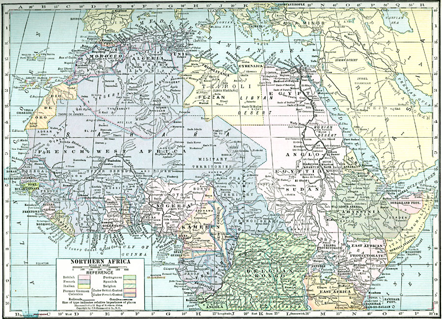
Description: A political map of the northern part of the African continent after WWI with reference to territories controlled by European countries and showing the former German territories ceded by the Treaty of Versailles to France and Britain. This map includes major cities, railroads and canals, rivers, and major landforms.
Place Names: A Regional Map of Africa, Nigeria, �Egypt, �Algeria, �Somalia, �Rio De Oro, �Morocco, �Tunis, �Tripoli, �Anglo-Egyptian Sudan, �Abyssinia, �Eritrea, �Belgian Kongo, �Kamerun, �French West Africa
ISO Topic Categories: boundaries,
location,
inlandWaters,
oceans,
transportation
Keywords: Post WWI Northern Africa, physical, �transportation, kVersailles, physical features, railroads,
water routes, boundaries,
location,
inlandWaters,
oceans,
transportation, Unknown, 1920
Source: , Hammond's Modern Atlas of the World (New York, New York: C. S. Hammond and Company, Inc., 1920) 51
Map Credit: Courtesy the private collection of Roy Winkelman |
|