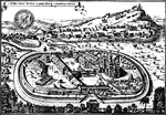
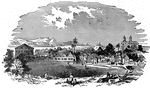
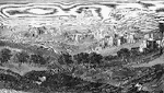
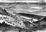
A German Benedictine Monastery with a Small Town in the Background - Aerial View
An aerial view of a German Benedictine Monastery compound. A small town is nestled at the foot of a…
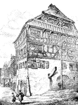
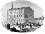
Albrecht Dürer's House in Nürnberg
"Albrecht Dürer's House in Nürnberg. From the engraving in Dibdin's 'Biographical Tour.'"…
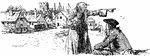
Ancient Mariner
From Coleridge's The Rime of the Ancient Mariner. An old mariner tells his tales to a young man who…
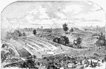
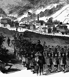
Union Prisoners Confined at the Confederate Prison at Andersonville
Union soldiers being held at Andersonville, a Confederate prison.
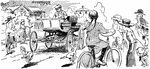
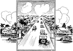
Automobile Driving Through the Neighborhood
Neighborhood people look in amazement at the first automobile driving down the road.
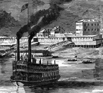
Bellaire
"Bellaire, O.- Steamboats conveying troops and munitions of war for the Federal forces on the Great…
Bellaire
"Bellaire, O.- Steamboats conveying troops and munitions of war for the Federal forces on the Great…
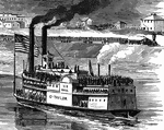
Bellaire, Ohio
"Bellaire, O.- Steamboats conveying troops and munitions of war for the Federal forces on the Great…
Bellaire
"Bellaire, O.- Steamboats conveying troops and munitions of war for the Federal forces on the Great…
Bethlehem
Bethlehem, pictured as it was in 1833. Bethlehem is a city with a great deal of religious significance.…
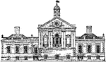
Bridgenorth
The seal of Bridgenorth, a parliamentary and municipal borough and market town of England, in the county…
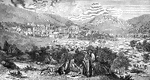
Chattanooga, Tennessee in 1862
Chattanooga, "the Scenic City", is the fourth-largest city in Tennessee (after Memphis, Nashville, and…
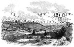
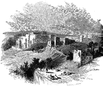
Village of Clarksburg
"Village of Clarksburg, Western Virginia, headquarters of General Rosecrans. Clarksburg, a post village,…
Village of Clarksburg
"Village of Clarksburg, Western Virginia, headquarters of General Rosecrans. Clarksburg, a post village,…
Village of Clarksburg
"Village of Clarksburg, Western Virginia, headquarters of General Rosecrans. Clarksburg, a post village,…

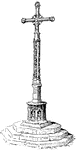
Market Cross
A market cross is a structure used to mark a market square in market towns, originally from Western…
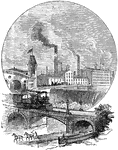
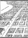
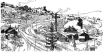
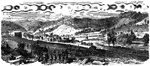
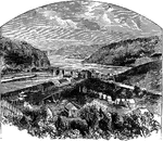
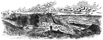
Factory Near River & Train Tracks
An illustration of a factory set near a river with a train track on a bridge.
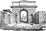
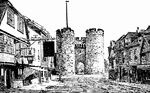
Gate at Herculaneum
The gate at Herculaneum. Herculaneum was an ancient Roman town famous for being preserved along with…
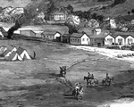
View of Grafton
"View of Grafton, West Virginia, occupied by the Federal Troops, under the command of General McClellan,…
Grafton Occupied by Federal Troops
"View of Grafton, West Virginia, occupied by the Federal Troops, under the command of General McClellan,…
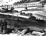
Railroad at Grafton
"View of Grafton, West Virginia, occupied by the Federal Troops, under the command of General McClellan,…
Federal Troops at Grafton, West Virginia
"View of Grafton, West Virginia, occupied by the Federal Troops, under the command of General McClellan,…
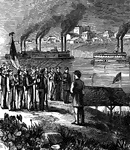
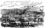
Jefferson City, Missouri
"Jefferson City, capital of Missouri. The arrival of General Fremont's division, September 26th, 1861.…
Jefferson City Railroad Depot
"Jefferson City, capital of Missouri. The arrival of General Fremont's division, September 26th, 1861.…
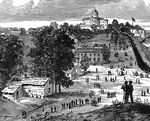
Jefferson City Capitol Building
"Jefferson City, capital of Missouri. The arrival of General Fremont's division, September 26th, 1861.…
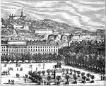
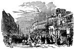
The City of Lyons, France
Lyons-la-Forêt is a commune in the Eure department in Normandy, in northern France. Because of…
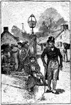
Man & Boy Near Lamp Post
An illustration of a man with a top hat and cane standing near a lamp post and a boy sitting on a feed…
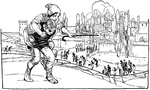
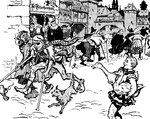
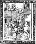
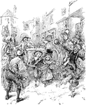
Man Carrying Woman on Back Near Town
An illustration of a man carrying a woman on his back with a town in the background.
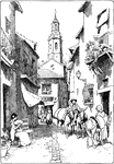
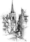
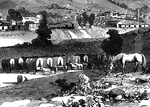
Narrow Street in Spain
This image depicts citizens along a narrow road in Spain. A woman rests in chair while donkeys walk…
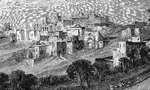
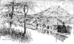
View of Nazareth
The town of Nazareth against a backdrop of mountains in the distance. Groups of men rest in the foreground
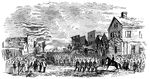
New Fernandina
"Federal troops marching through Second Street, New Fernandina, Fla. Our sketch of New Fernandina in…
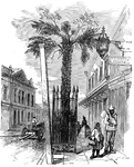
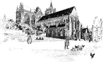
Streets of Pompeii
An illustration of the streets of Pompeii. Pompeii is a ruined and partially buried Roman town-city…