Search for "geography"
Lycian Tomb
"Lycia was, in ancient geography, a country on the S. coast of Asia Minor, extending toward Mount Taurus,…
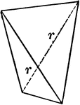
Sphenoid
"It consists of four isoceles triangular faces which intersect all three of the crystallographic axes,…
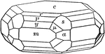
Apatite
"A complex crystal of apatite with the faces of a third-order pyramid upon it." — Ford, 1912

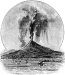
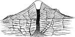
Section of a volcano
"The internal structure of many cones has been laid bare by prolonged erosion after the volcano has…
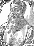
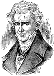
Ptolemy (Claudius Ptolemaeus)
Claudius Ptolemaeus, known as Ptolemy, was an ancient geographer, astrologer, and astronomer.
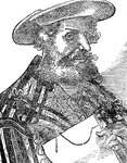
Ptolemy Holding a Document
Claudius Ptolemaeus, known as Ptolemy, was an ancient geographer, astrologer, and astronomer.
Edwin J. Houston
Professor of Physical Geography and Natural Philosophy in the Central High School of Philadelphia; Professor…
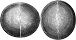
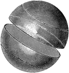
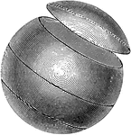
Oblate and Prolate Spheroid
The shape of the earth is that of a round ball or sphere slightly flattened at two opposite sides. Such…
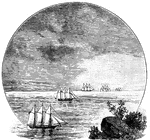
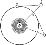
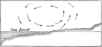
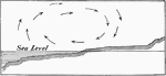
Curvature of the Earth's Surface
If the earth were flat, as soon as an object appeared on the horizon we would see the upper and lower…
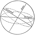
Great Circle
A Great Circle is one which would be formed on the earth's surface by a plane passing through the earth's…
Small Circle
A small circle is one formed by a plane which does not cut the earth into two equal parts. The small…
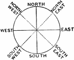
Meridians and Parallels
The Meridian of any given place is that half of the meridian circle which passes through that place…
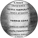
Mathematical Climate Zones
These zones, which are separated by the parallels of latitude, are generally termed the astronomical…
Volcanic Dykes and Parasitic Cones
The sides of volcanic cones are often rent during the eruption, and the fissures filled with lava, which…
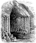
Basaltic Columns
Basaltic Columns at Finagl's Cave in Scotland. It is formed entirely from hexagonally-jointed basalt.
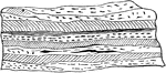
Stratified Rock
The different layers or strata are shown by the shadling's. Stratified rocks are the most common of…
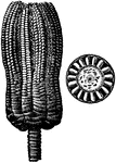
Fossil Encrinite
When the remains of an animal or plant are exposed to the air or buried in dry earth, they generally…
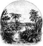
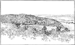
Carboniferous Landscape
The continents during this age consisted mainly of large, flat, marshy areas, covered with luxuriant…
Baron von Humboldt
(1769-1859) "A German traveler and naturalist, the founder of the modern science of physical geography."…
Stratified Layers
"Ideal section of part of the earth's crust, with landscape above. Granite and other crystalline rocks…
Map Measurer
"The map measurer is an instrument specially designed for quickly measuring distances or lines on a…
Engineer's Scale
"Measurement of distance on a map by means of an engineer's scale." -U.S. Chief of Engineers
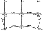
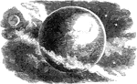
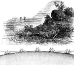
Earth Curvature
"The sun is so far away that it would appear at the same angle from Philadelphia, St. Louis, and Denver,…
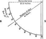
Heliotrope
An instrument used in geography to measure angles of the sun at different times of the day.
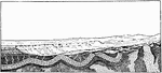
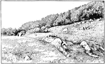
Fault Scarps
"Fault scarps of Orenaug Hill (floating block topography). The view is taken from the top of a cliff…
Orographic Blocks
"Unit orographic blocks in granite, near the knife works, Hotchkissville. a Area over downthrown block."…
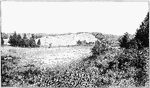
Fault Scarp Slope
"View of the southeastern slope of the eastern twin of Orenaug Hill. Fault scarps bound the hummocky…
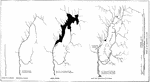
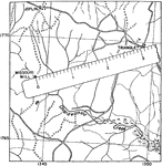
Erosion Stages
"Maps to illustrate the supposed stages in the erosion history of the Pomperaug River." -Walcott, 1901
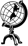
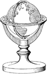
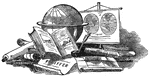
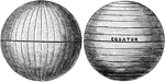
Terrestrial Globe
"An artificial sphere on whose surface is drawn a map or representation of the earth." -Whitney, 1911
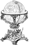
Oronce Fine
This border was designed by Oronce Fine a French Mathematician and Cartographer in 1534. It has a design…