|
|
|
| Maps > Globes & Multi-Continent > Regional Maps >Regional Pacific Ocean |
Regional Globes & Multi-Continental maps of the Regional Pacific Ocean region from the Maps ETC collection. This may include physical and political maps, early history and empires, climate maps, relief maps, vegetation maps, population density and distribution maps, cultural maps, and economic/resource maps.
|
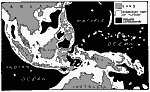
Continental Plateau Between Asia and Australia,
1888 |
|
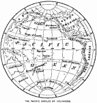
Pacific Girdled by Volcanoes,
1890 |
|
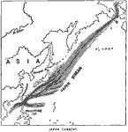
Japan Stream,
1890 |

|
Polynesian Island Chain,
1891 |
|
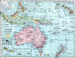
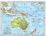
Oceania,
1899 |
|
Australia and the Islands of the Pacific,
1901 |

|
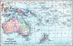
Political and Physical Map of Australia and the Islands of the Pacific,
1902 |
|
Map of Australia and the Pacific Islands,
1903 |

|
U.S. Possessions in the Pacific Islands,
1903 |

|
Oceania,
1904 |
| First | Previous | Next | Last |
| Maps > Globes & Multi-Continent > Regional Maps >Regional Pacific Ocean |
Maps
is a part of the
Educational Technology Clearinghouse
Produced by the
Florida Center for Instructional Technology
© 2009
College of Education
,
University of South Florida