| Maps > United States > Connecticut |
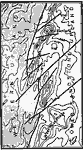 |
West Rock Ridge, A map showing the displacement of trap ridges near northern end of West Rock Ridge and corresponding displacement in the crystallines of the bordering uplands. |
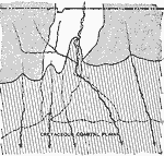 |
Connecticut Shore Overlap, A map of the inferred Cretaceous overlap on the southern shore of Connecticut. |
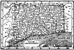 |
Map of Connecticut, Map of Connecticut. |
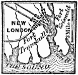 |
New London, 1781 A map showing New London, and Fort Trumbull. |
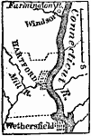 |
Vicinity of Hartford, 1872 A map showing the vicinity of Hartford, Connecticut. |
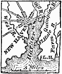 |
New Haven, 1872 It is about seventy-five miles N.E. from New York, and thirty-four S.W. from Hartford. |
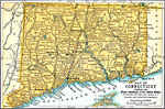 |
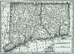
Connecticut, 1891 A map of Connecticut in 1891. |
 |
Connecticut, 1906 Map of Connecticut in 1906. |
 |
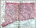
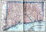
Connecticut, 1912 A map of Connecticut in 1912. |
 |
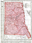
Connecticut, 1919 A map of Connecticut in 1919, showing railway routes and towns. |
 |
Connecticut, 1922 Physical map of Connecticut. |
| Maps > United States > Connecticut |
Maps is a part of the Educational Technology Clearinghouse
Produced by the Florida Center for Instructional Technology © 2007
College of Education, University of South Florida