| Maps > United States > Ohio |
 |
The Great Sepent Mound, Ancient America An overhead view of the Great Serpent Mound, constructed by ancient Native Americans in what is now Ohio. |
 |
Map of Ohio, Map of Ohio. |
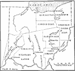 |
The Districts of Ohio, late 1700s Map showing the political districts of Ohio. |
 |
Scioto Valley, 1847 A map of a section of twelve miles of the Scioto Valley, showing its ancient monuments. |
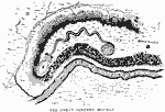 |
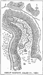
The Great Serpent Mound, 1851 A map of the Great Serpent Mound in Ohio. |
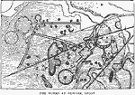 |
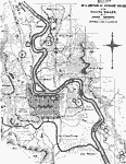
Works at Newark, Ohio, 1862 A map of the works at Newark, Ohio, made from surverys "executed while the chief earthworks could still be traced in all their integrity". |
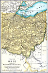 |
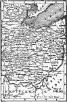
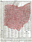
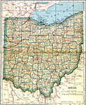
Ohio, 1891 A map of Ohio in 1891. |
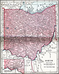 |
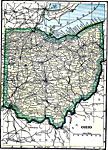
Ohio, 1906 Map of Ohio in 1906. |
 |
Ohio, 1912 A map of Ohio in 1912. |
 |
Ohio, 1919 A map of Ohio in 1919, showing cities and railway routes. |
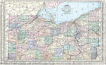 |
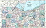
Ohio (Northern Part), 1920 Map of northern part of Ohio. |
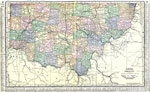 |
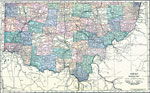
Ohio (Southern Part), 1920 Map of southern part of Ohio. |
 |
Northern Ohio, 1920 Physical map of the northern part of Ohio. Includes railroads and canals. |
 |
Southern Ohio, 1920 Physical map of the southern part of Ohio. Includes railroads and canals. |
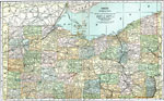 |
Northern Ohio, 1920 The northern part of Ohio. |
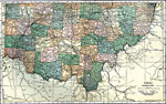 |
Southern Ohio, 1920 The southern part of Ohio. |
 |
Ohio, Post World War I Map of Ohio. |
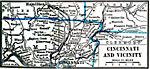 |
Cincinnati and Vicinity, 1922 cincinnati and neighboring counties. |
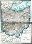 |
Ohio, 1922 Physical map of Ohio. |
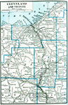 |
Cleveland and Vicinity, 1922 Cleveland and neighboring counties. |
| Maps > United States > Ohio |
Maps is a part of the Educational Technology Clearinghouse
Produced by the Florida Center for Instructional Technology © 2007
College of Education, University of South Florida