| Maps > United States > New Jersey |
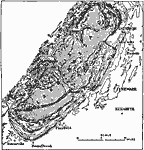 |
Maximum Stage of Lake Passiac, A map showing the maximum stage of Lake Passaic. All outlets except that at Moggy Hollow were either blocked by ice or filled with drift. |
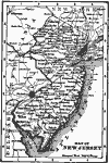 |
Map of New Jersey, Map of New Jersey. |
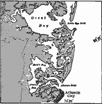 |
Coast of New Jersey, A map showing the sand reef, salt marsh, and coastal plain upland, coast of New Jersey. |
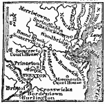 |
Seat of War in New Jersey, 1776 A map showing the seat of the Revolutionary War in New Jersey. |
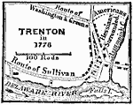 |
Trenton in 1776, 1776 A map showing Trenton and the military forces there during 1776. |
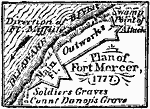 |
Fort Mercer, 1777 Fort Mercer, now in ruins, was a little above, at Red Bank on the New Jersey side, and little more than a mile distant from Fort Mifflin. |
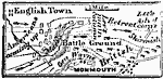 |
Battle of Monmouth, 1778 A map showing the area where the Battle of Monmouth was fought in 1778. |
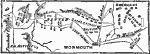 |
Battle of Monmouth, June 28, 1778 A plan of the Battle of Monmouth, during the American Revolution. |
 |
Relief Map of New Jersey, 1872 Relief map of New Jersey. — Comprehensive Geography, 1872 |
 |
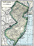
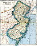
New Jersey, 1891 A map of New Jersey in 1891. |
 |
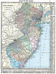
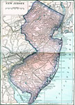
New Jersey, 1906 Map of New Jersey in 1906. |
 |
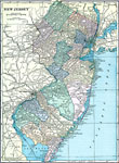
New Jersey, 1912 A map of New Jersey in 1912. |
 |
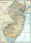
New Jersey, 1919 A map of New Jersey, showing cities and railroad routes. |
 |
New Jersey, 1920 Map of New Jersey. |
 |
New Jersey, 1920 Physical map of the western part New Jersey. |
 |
New Jersey, 1920 The state of New Jersey. |
 |
New Jersey, Post World War I Map of New Jersey. |
 |
New Jersey, 1922 Physical map of New Jersey. |
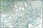 |
Northeastern New Jersey, 1922 Northeastern counties of New Jersey. |
| Maps > United States > New Jersey |
Maps is a part of the Educational Technology Clearinghouse
Produced by the Florida Center for Instructional Technology © 2007
College of Education, University of South Florida