Trap Ridges
| View Cart ⇗ | Info
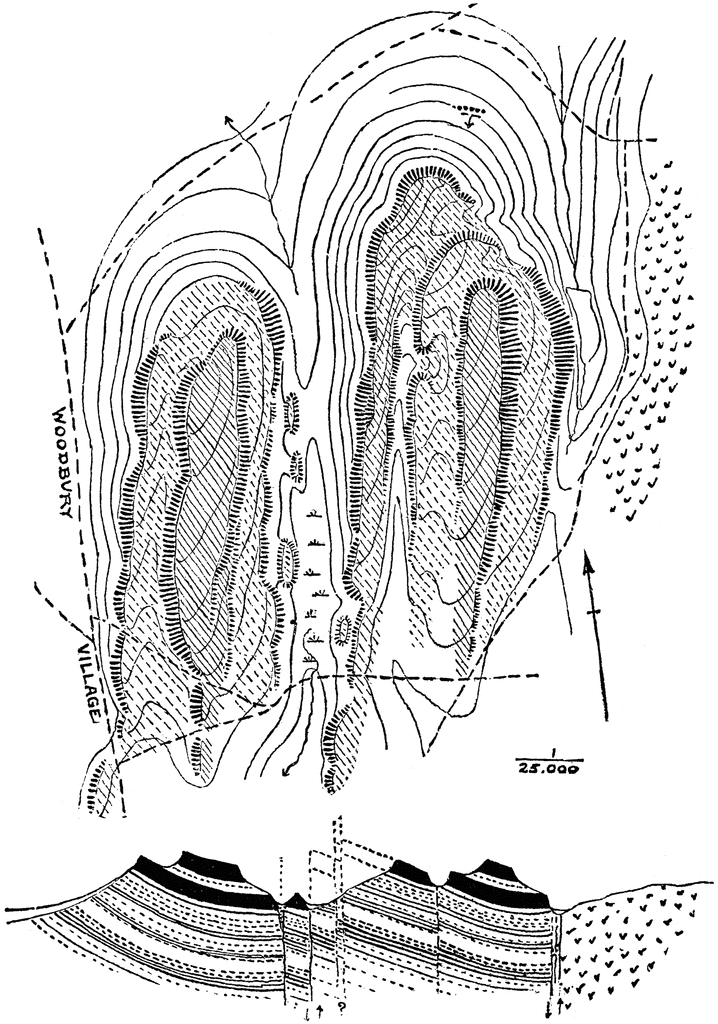
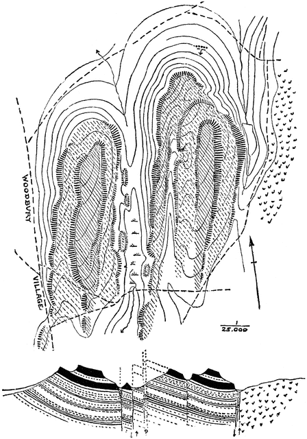
“Map and section of trap ridges near Woodbury. The topography is indicated by sketched contours, with hachures for trap bluffs. The lower sandstone slopes are all covered, and the northern bluff of the western group of ridges is quite buried in drift. The crystalline rocks appear on the east. The section suggests an interpretation of the surface forms.” -Walcott, 1901
Keywords
geology, topography, layers, contour map, trap ridges, hachures, trap bluffs, sandstone slopes, crystalline rocksSource
Walcott, Charles D. Annual Reports of the Department of the Interior (Washington, DC: Government Printing Office, 1901)
Downloads
1683×2400, 1.1 MiB
718×1024, 160.5 KiB
448×640, 82.0 KiB
224×320, 26.4 KiB