This science ClipArt gallery offers 98 images of the science of hydrology, which is the study of water movement, distribution, and quality throughout Earth. This gallery contains images involving hydrology, including water movement and creation of atolls and barrier reefs, and water tables.
River Channel
"A broad, shallow river channel" that would flow slower than a deeper, narrower channel. -Salisbury,…
River Channel
A deep, narrow river channel that would flow faster than a broader, shallower channel.
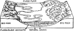
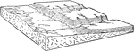
Flood Plain of a River
Block diagram showing the flood-plain of a river, with ox-bows and marginal streams and in section,…
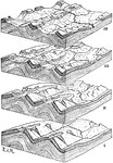
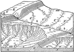
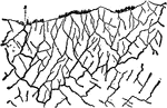
Development of River Systems
Diagrams showing the development of river systems in anticlinal folds with anticlinal valleys as the…
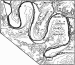
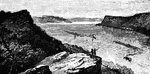
Meanders of the Seine
Intrenched meanders of the Seine in the old peneplane cut upon the strata of the Paris Basin; near Rouen.
Stream on an Anticline
A stream incised upon the axis of a broad anticline, where it happened to be located at the beginning…
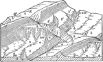
Overdeepened Subsequent Stream
Subsequent streams are streams whose course has been determined by selective headward erosion along…
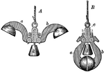
Taselli's Sounding Apparatus with Cups Opened and Closed
"To measure the depth of; fathom; try or test, as the depth of water and the quality of the ground,…
Wave-Build Terrace
"In some cases the shore current builds up the beach above sea level and adds to it on the seaward side,…
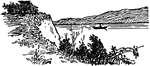
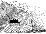
Wave-Cut Terrace
"Waves act like a horizontal saw which makes a wide cut into the land, extending above and below the…
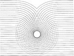
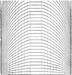
Island Tides
The figure "shows the effect of a circular island upon the cotidal lines." -Coast and Geodetic Survey,…
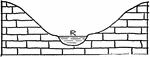
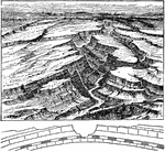
Valley
"Diagram of a valley, the top of which is ten times the width of the stream." -Salisbury, 1919
Water Circulation
This diagram shows waters transition from rain, to ground water, and back up to rain again.
Water Table
"If the water table about a lake is above the lake level, there will be no leakage from the lake, even…
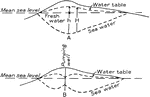
Water Table
"(a)--Diagrammatic cross section of an island or peninsula showing relations of fresh ground water and…

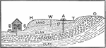
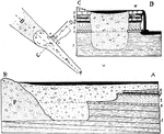
Underground Waters
The image shows different layers of clay, gravel, and sand and how underground waters travel through.…
Wave Motion
As the motion of the wave is moving in the right direction in this diagram, a, b, c, and d represent…
Wave Motion
"It is seen that the motion of each particle is rectilinear and simple harmonic...The paths are vertical…
Wave Movement
"The line AB represents the surface of a water wave whose length is ai, moving in the direction of the…
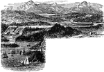
Wave Progress
The figure "represents the progress of a wave up a broad depression or valley 40 miles wide at the bottom…
Breaking Wave Diagram
Diagram showing the development of the breaking wave and the "swash" after breaking.
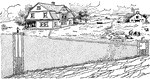
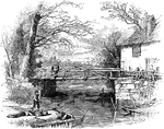
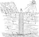
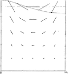
Well Water
How the well often becomes impure and carries disease. A well near a barnyard or cesspool is likely…
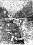
Whirlpool at Niagara
Sections of the Whirlpool at Niagara before the former drift-filling was cleared out by the river.
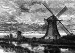
Windmills along a Canal
Windmills stand along a canal. The are probably polder mills used to move water up and out of lowlands,…