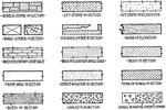
Symbols of Building Materials
Series of conventional symbols for building materials in architecture.
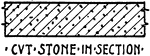
CVT Stone in Section Material Symbol
Common material symbol for CVT Stone in Section for architectural and mechanical drawing.
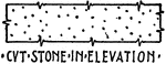
CVT Stone in Elevation Material Symbol
A widely accepted building material symbol for CVT Stone in Elevation used in architectural and mechanical…
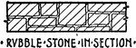
Rubble Stone in Section Material Symbol
A commonly used symbol for Rubble Stone in Section used in architectural and mechanical drawing.
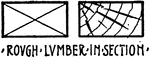
Rough Lumber in Section Material Symbol
Building material symbol for Rough Lumber in Section commonly used in architectural and mechanical drawing.
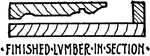
Finished Lumber in Section Material Symbol
Conventional building symbol for Finished Lumber in Section commonly used in architectural and mechanical…
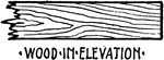
Wood in Elevation Material Symbol
A building material symbol used in architectural or mechanical drawing for Wood in Elevation.
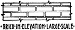
Brick in Elevation Large Scale Material Symbol
Conventional material symbol used in architectural and mechanical drawing for Brick in Elevation Large…
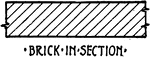
Brick in Section Material Symbol
Brick in Section conventional material symbol is commonly used in architectural and mechanical drawing.
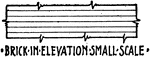
Conventional Symbol of Brick in Elevation Small Scale
Architectural and mechanical conventional building material symbol for Brick in Elevation Small Scale.
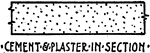
Cement and Plaster in Section Material Symbol
Building material conventional symbol for Cement and Plaster in Section commonly used in architectural…
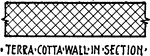
Terra Cotta Wall in Section Material Symbol
A commonly used material symbol in mechanical and architectural drawing for Terra Cotta Wall in Section.
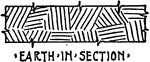
Earth in Section Material Symbol
Mechanical and architectural drawing building material symbol for Earth in Section.
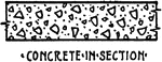
Concrete in Section Material Symbol
Concrete in Section conventional building material symbol used in architectural and mechanical drawing.
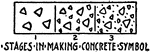
Stages in Making Concrete Material Symbol
Architectural and mechanical drawing material symbol for Stages in Making Concrete Symbol.
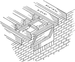
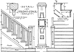
Stair Detail
"Stair details and the like may be shown with sufficient clearness to the scales of 3/4" or 1". Mouldings…
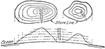
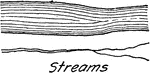
Shoreline Contour
"A contour is a line on the surface of the ground which at every point passes through the same elevation,…
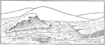
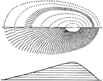
Perspective View of Shoreline
A perspective view of the shoreline illustrated by using contour lines.
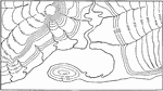
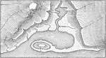
Shoreline Contour Map Method of Execution
"The contours are sketched lightly in pencil and the hachures drawn perpendicular to them, starting…
Shoreline Hill Shading by Hachures Contour Map
"The showing of relief by means of hill shading gives a pleasing effect but is very difficult of execution,…
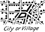
City or Village Topography Symbols
A conventional topographic symbol of a city or a village commonly used in map drawing.
Double Track Railroads Topography Symbols
A double railroad track map or topography symbol for drafting and map drawing
Electric Railway Topography Symbols
A conventional topographical electric railway symbol for drawing maps and drafting.
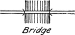
Bridge Topography Symbols
Illustrated conventional symbol for a bridge commonly used in drafting and map drawing.
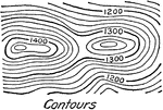
Contour Relief or Terrain Topography Symbol
A terrain or relief topography symbol for contours illustrating elevation of the land commonly used…
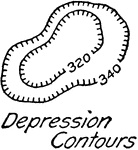
Depression Contour Relief or Terrain Topography Symbol
A depression contour relief or terrain topography for drafting and map drawing illustrating lower land…
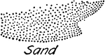
Sand Relief or Terrain Topography Symbol
Conventional sand topography symbol commonly used in map drawing and drafting.
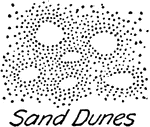
Sand Dunes Relief or Terrain Topography Symbol
A map drawing and drafting topography symbol illustrating sand dune.
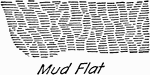
Mud Flat Relief or Terrain Topography Symbol
Topographical symbol for mud flat, or mud deposit from the mud, used in drafting and map drawing.
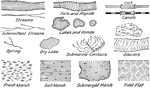
Water Features Topography Symbol
A series of topographical symbols for water features commonly used in drafting and map drawing.
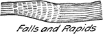
Falls and Rapids Topography Symbol
A commonly used drafting and map drawing conventional symbol for falls and rapids.
Water Feature Lock Topography Symbol
A water lock conventional symbol used in map drawing and drafting. A lock is used to lower or raise…
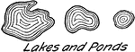
Lakes and Ponds Topography Symbol
A common topography symbol for lakes and ponds used in drawing maps and drafting.
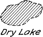
Dry Lake Topography Symbol
Topography symbol for dry lake conventionally used in map drawing and drafting.
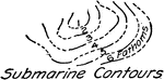
Submarine Contours Topography Symbol
A submarine contour, underwater low elevation, conventional topographic symbol used for drafting and…
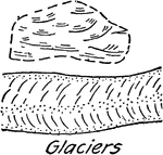
Glaciers Topography Symbol
A conventional glacier topography symbol commonly used in drafting and map drawing.
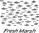
Fresh Water Marsh Topography Symbol
Topography map symbol for fresh water marsh used in drafting and map drawing.
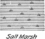
Salt Water Marsh Topography Symbol
A conventional topographical water feature for salt water marsh used in drafting and map drawing.
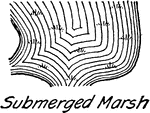
Submerged Marsh Topography Symbol
Conventional topography symbol for submerged marsh used in drafting and map drawing.
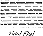
Tidal Flat Topography Symbol
A tidal flat topography conventional symbol commonly used in drafting and map drawing.
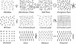
Vegetation Topography Symbol
A series of conventional topography symbol for vegetation used in map drawing and drafting.
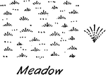
Meadow Vegetation Topography Symbol
A conventional topography vegetation symbol for meadow used in map drawing and drafting.
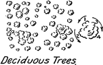
Deciduous Trees Vegetation Topography Symbol
Vegetation topography symbol for deciduous trees convention in drafting and map drawing.
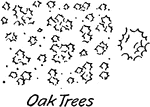
Oak Trees Vegetation Topography Symbol
A conventional oak tree vegetation symbol used in map drawing and drafting.
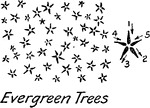
Everglade Trees Vegetation Topography Symbol
A vegetation Everglade tree for topography symbol used in map drawing and drafting.
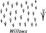
Willows Vegetation Topography Symbol
A map drawing or drafting conventional vegetation symbol for willow.
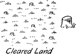
Cleared Land Vegetation Topography Symbol
Cleared land vegetation topography symbol used in map drawing and drafting.
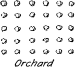
Orchard Vegetation Topography Symbol
A conventional vegetation topography for orchard commonly used in map drawing and drafting.
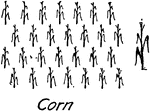
Corn Vegetation Topography Symbol
Topography conventional symbol for corn used in map drawing and drafting.
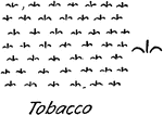
Tobacco Vegetation Topography Symbol
A conventional map drawing and drafting topography symbol for tobacco.
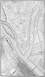
Topographic Map
An illustration of a topographic map using conventional symbols commonly used in drafting and map drawing.
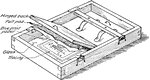
Blue Print Frame
A blue print frame used to make copies of mechanical drawing. The process is done by exposing a sensitized…
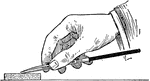
Sharpening Pen using Stone
An illustration of sharpening a pen to equal shape and length using a a stone soaked in oil. The pen…
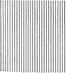
Even Line Shading Tint
An illustration of even line shading using ruled lines. Lined shading is commonly used in patents.