Maps Site map
  Maps > Europe > Complete Maps
Site Map  

  Record   21   to   30  of   121

Historic and contemporary maps of Europe, including physical and political maps, early history and empires, WWI maps, climate maps, relief maps, vegetation maps, population density and distribution maps, cultural maps, and economic/resource maps.

Europe at the Height of Napoleon's Power, 1811
"Napoleon was now at the zenith of his power. He ruled directly over an empire that was far larger than the former Kingdom of France. In 1809 he annexed what remained of the Papal States in Italy, together with the incomparable city of Rome, thu...

Europe, 1815
A map of Europe highlighting the German Confederacy created by the Congress of Vienna in 1815, the successor to the Holy Roman Empire of the German Nation. The confederacy was made up of 39 states including portions of the Austrian Empire and the Kin...

Europe, 1815
A colored outline map of Europe in 1815, after the Congress of Vienna. Territories are numbered and referenced on the map....

Europe After the Congress of Vienna, 1815
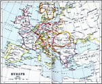
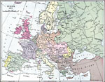
A color map of Europe after the Congress of Vienna in 1815, which redrew the continent's political boundaries after the French Revolution, Napoleonic Wars, and the dissolution of the Holy Roman Empire. This map is color–coded to show lands cont...

Europe, 1815
This map depicts Europe in 1815 after the fall of the French Empire and the creation of the German Confederation by the Congress of Vienna....

Europe, 1848–1871
A map of Central Europe between 1848 and 1871 showing Prussia, the German Empire, the French gains in Savoy and Nice, and losses in the Alsace–Lorraine territory, the Austria–Hungary Empire, the Kingdom of Italy, and the Ottoman Empire....

Map of Europe, 1858
A map of Europe in 1858 showing country borders of the time, including Prussia, Bavaria, Saxony and European Turkey, and regions including Poland in Russia, Galicia, Hungary, Croatia, Dalmatia, Slavonia, and Transylvania in Austria, and Moldavia, Ser...

Europe (Physical), 1868
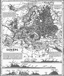
A map from 1868 of Europe, showing the physical features, climate, and commercial resources of the region. Mountain chains are represented by lines of varying thickness, with the broader the line, the greater the elevation. The highest points of moun...

Europe, 1870
A physical and political map showing country boundaries of Europe as they existed in 1870, including major cities, rivers, and landforms. This map also includes an outline map of Pennsylvania for area size comparison. ...

Europe, 1871
A map showing country boundaries of Europe as they existed in 1871, including major cities and railroad routes....

First Previous Next Last


  Maps > Europe > Complete Maps
Site Map  

Maps ETC is a part of the Educational Technology Clearinghouse
Produced by the Florida Center for Instructional Technology © 2009
College of Education, University of South Florida