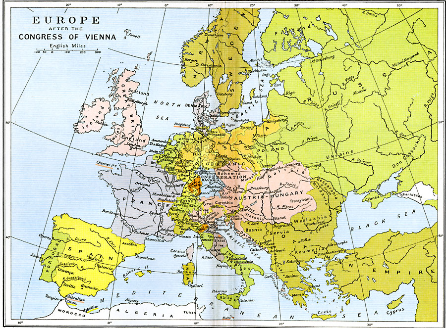
Description: A color map of Europe after the Congress of Vienna in 1815, which redrew the continent's political boundaries after the French Revolution, Napoleonic Wars, and the dissolution of the Holy Roman Empire. This map is color–coded to show lands controlled by the German Confederation, including Holstein, Hamburg, Mecklenburg, Hanover, Luxemburg, Hesse, Saxony, Baden, Bavaria, Bohemia, and the western portions of Prussia and Austria. Non–Confederation countries shown include Norway, Sweden, Finland, Great Britain, Denmark, Netherlands, France, Portugal, Spain, Swiss Confederation, Sardinia, Corsica, Lombardo–Venetia, Parma, Modena, Lucca, Tuscany, States of the Church, The Two Sicilies, eastern Austria–Hungary, Galicia, Poland, portions of Russia and the Ottoman Empire, and the eastern portion of Prussia. Major rivers, cities, and ports are shown.
Place Names: A Complete Map of Europe, Austria, �Bosnia, �England, �France, �Great Britain, �Hungary, �Netherlands, �Norway, �Poland, �Portugal, �Spain, �Sweden, �Switzerland, �Tuscany, German Confederation, Holstein, Hamburg, Mecklenburg, Hanover, Luxemburg, Hesse, Saxony, Baden, Bavaria, Bohemia, Prussia, Finland, Denmark, Swiss Confederation, Sardinia, Corsica, Lombardo-Venetia, Parma, Modena, Lucca, States of the Church, The Two Sicilies, Austria-Hungary, Galicia, Russia, Ottoman Empire
ISO Topic Categories: oceans,
location,
inlandWaters,
boundaries
Keywords: Europe After the Congress of Vienna, political, country borders,
local jurisdictions,
major political subdivisions, oceans,
location,
inlandWaters,
boundaries, Unknown, 1815
Source: Ward, Prothero, and Leathes, The Cambridge Modern History Atlas (New York, NY: The Macmillan Company, 1912)
Map Credit: Courtesy the private collection of Roy Winkelman |
|