Maps Site map
  Maps > Europe > Greece
Site Map  

  Record   51   to   53  of   53

Historic and contemporary maps of Greece and Hellas, including political and physical maps, early empires, city plans, and battle plans.

The Greek Colonies, circa 550 BC
A map of the Mediterranean and Black Sea during the Greek colonial period around 550 BC, showing the settlements of Tarentium (Taranto), Magna, Catana, Syracuse, Burka, Naukratis, Crete, Heraclea, Sinope, and Olbia....

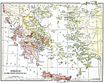
Greece, Fifth Century B.C.
Map of Greece in the Fifth Century B.C....

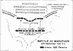
Battle of Marathon, September 29, 490 BC
A map of the Battle of Marathon between the Greek forces under Miltiades and Persian forces under General Datis. This battle, fought on September 29, 490 B.C., was a decisive victory for the Greeks....

First Previous


  Maps > Europe > Greece
Site Map  

Maps ETC is a part of the Educational Technology Clearinghouse
Produced by the Florida Center for Instructional Technology © 2009
College of Education, University of South Florida