|
|
|
| Maps > Europe > Greece |
Historic and contemporary maps of Greece and Hellas, including political and physical maps, early empires, city plans, and battle plans.
|
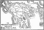
The Peloponnesian League,
500 BC |
|
Hellas,
550 BC |
|
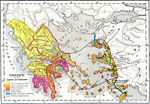
Greece at the Dawn of History,
700 BC |
|
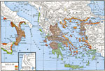
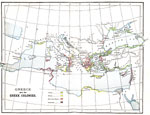
Greece and the Greek Colonies,
734–600 BC |
|
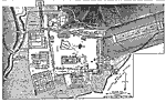
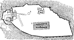
Plan of Olympia,
776–445 BC |
|
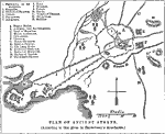
Plan of Ancient Athens,
Ancient Athens |
|
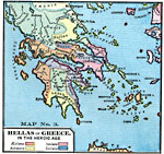
Hellas or Greece in the Heroic Age,
Circa 500 BC |
|
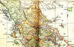
General Reference Map of Ancient Greece,
Circa 500 BC |
|
Plan of the Acropolis,
Circa 500 BC |

|
Plan of Athens,
Circa 500 BC |
| First | Previous | Next | Last |
| Maps > Europe > Greece |
Maps ETC is a part of the Educational Technology Clearinghouse
Produced by the Florida Center for Instructional Technology © 2009
College of Education, University of South Florida