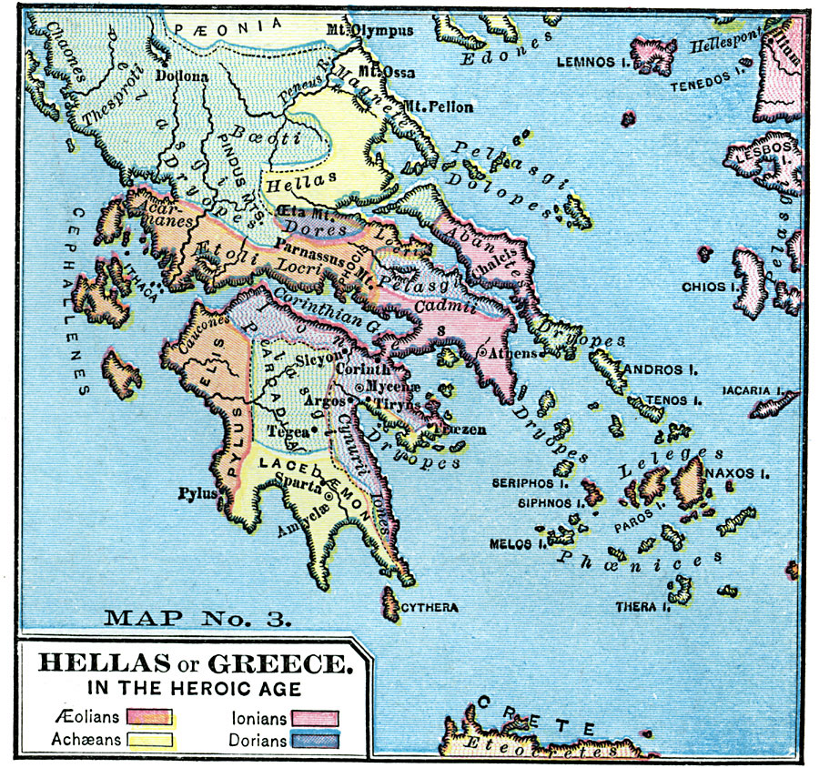
Description: A map of Hellas during the "Heroic Age" (one of the five Ages of Man according to Hesoid – Gold, Silver, Bronze, Heroic, and Iron ages), the time of demigods and men between the events of the Theogny to Troy. The map is color–coded to show the territories of the &Aelig;olians, Achæans, Ionians, and the Dorians.
Place Names: Greece, Athen
ISO Topic Categories: boundaries,
location,
inlandWaters
Keywords: Hellas or Greece in the Heroic Age, physical, �political, kAncientGreece, physical features, major political subdivisions, boundaries,
location,
inlandWaters, Unknown, Circa 500 BC
Source: James Monteith, Comprehensive Geography (New York, New York: A. S. Barnes and Company, 1872) 91
Map Credit: Courtesy the private collection of Roy Winkelman |
|