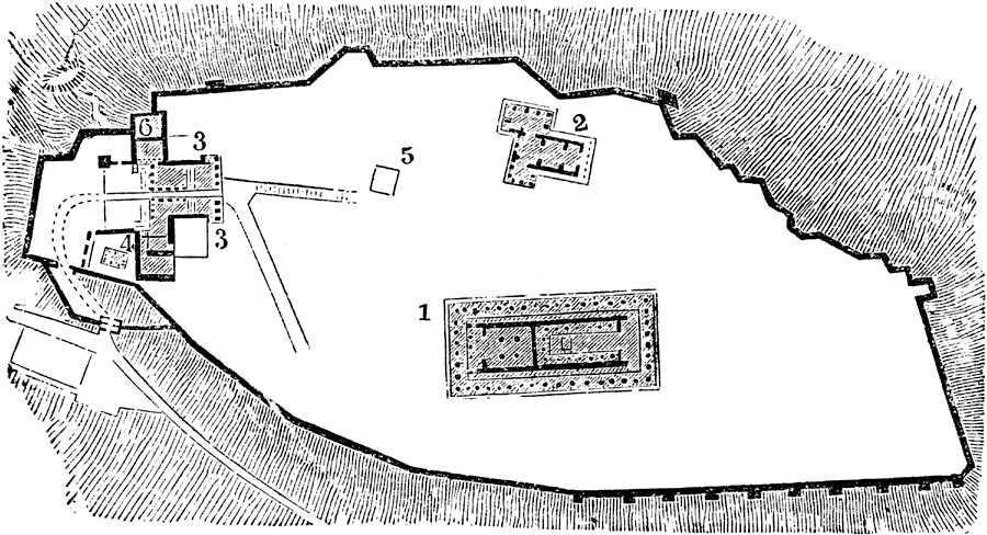
Description: "After the Persian wars the Acropolis had ceased to be inhabited, and was appropriated to the worship of Athena and to the other guardian deities of the city."— Smith
Place Names: Greece, Athens, �Parthenon, �Erechtheum, �Propylaea, �Temple of Nike Apteros,
ISO Topic Categories: location,
inlandWaters,
structure
Keywords: Plan of the Acropolis, physical, physical features, location,
inlandWaters,
structure, Unknown,Circa 500 BC
Source: William Smith, A Smaller History of Greece (New York, NY: Harper and Brothers, 1882) 90
Map Credit: Courtesy the private collection of Roy Winkelman |
|