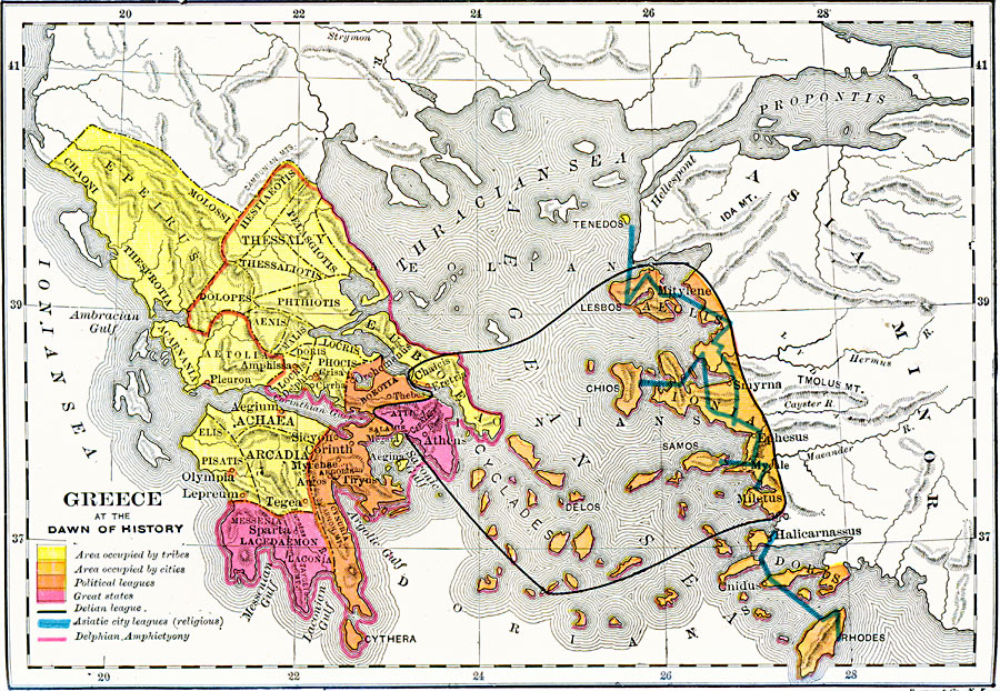
Description: A map of "Greece at the Dawn of History." This map is coloe–coded to show the territories occupied by tribes (yellow), by cities (light orange), by political leagues (dark orange), and the Great States (pink). The boundaries of the Delian league, Asiatic city leagues, and the Delphian Amphictyony are shown, as well as important cities of the time.
Place Names: Greece, Corinth, �Olympia, �Sparta, �Athens, �Laconia, �Mycenae, �Lesbo
ISO Topic Categories: boundaries,
inlandWaters,
location,
oceans,
society
Keywords: Greece at the Dawn of History, physical, �political, �statistical, kAncientGreece, physical features, country borders,
major political subdivisions, population, boundaries,
inlandWaters,
location,
oceans,
society, Unknown, 700 BC
Source: George Willis Botsford, Ph. D., A History of Greece (London, : The Macmillan Company, 1912) 29
Map Credit: Courtesy the private collection of Roy Winkelman |
|