Maps Site map
  Maps > Europe > Regional Maps >Western and Central Europe
Site Map  

  Record   11   to   20  of   121

Regional European maps of the Western and Central Europe region from the Maps ETC collection. This includes physical and political maps, early history and empires, WWI maps, climate maps, relief maps, vegetation maps, population density and distribution maps, cultural maps, and economic/resource maps.
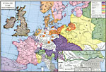
Europe, 1648
A map of Europe in 1648, subtitled "Peace of Westphalia." The map is color–coded to show the various territorial possessions, including the Habsburg, Spanish Habsburg, Hohenzollern, and Savoy possessions, France, Venice, Poland, and S...

Austrian Empire, 1648–1795
A map of the Austrian Empire, exclusive of the Italian Possessions and the Austrian Netherlands, subtitled, "Territorial Changes 1648–1795." The map is color–coded to show territories acquired and lost during this period. ...

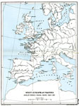
West European Waters, 1689–1763
A map of West European Waters, subtitled "Anglo–French Naval Wars 1689–1763." The map shows major coastal cities, ports, rivers, and coastal features in western Europe from the Baltic Sea, the British Isles, Bay of Biscay, Strai...

Europe, 16th and 17th Centuries
A map of the central portion of Europe in the 16th and 17th centuries showing principal cities, political boundaries, mountain ranges, and waterways....

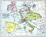
Western Europe, 16th Century
A map of Western Europe during the 16th Century, showing the domains and territories at the time. This map is color–coded to show the territories of the Habsburg possessions, Hohenzollern possessions, Savoy possessions, the French Dominion, Bou...

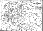
Northeastern Europe, 1701
A map of northeastern Europe during the time of Charles XII of Sweden. "Charles was but fifteen years of age when, in 1697, the death of his father called him to the Swedish throne. The dominions which came under his sway embraced not only Swede...

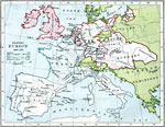
Western Europe, 1702
A map of Central and Western Europe in 1702 at the time of the death of William III and during the War of the Spanish Succession. The map is color–coded to show England and its allies and France and its allies at the start of the war of Spanis...

Western Europe, 1713–1714
A map of Western Europe in 1713–1714, showing the results of the treaties of Utrecht and Rastadt. The map is color–coded to show the territories of the Kingdom of Great Britain, Kingdom of France, Kingdom of Spain, Prussia, Duchy of Savoy...

Europe after the Treaty of Utrecht, 1714
A map of Europe in 1714 after the Treaty of Utrecht. This map shows the territories of Prussia, Sweden, the territories won from Sweden by Peter the Great in 1721, territories of the House of Austria (Habsburgs), and the boundary of the Holy Roman Em...

Europe, 1740
A map of Europe in 1740 indicating the European lands controlled by the House of Bourbon, the House of Hapsburg–Lorraine, the House of Savoy, the Kingdom of Prussia, and the Ottoman Empire. Smaller sovereignties are also shown including the Kin...

First Previous Next Last


  Maps > Europe > Regional Maps >Western and Central Europe
Site Map  

Maps is a part of the Educational Technology Clearinghouse
Produced by the Florida Center for Instructional Technology © 2009
College of Education , University of South Florida